Category:1910s maps of New Zealand
Jump to navigation
Jump to search

Media in category "1910s maps of New Zealand"
The following 5 files are in this category, out of 5 total.
-
 Map of New Zealand showing railway, steamer and coach routes - btv1b531534229.jpg 5,342 × 6,966; 3.88 MB
-
 Otago Map 1913.jpg 3,087 × 2,137; 2.08 MB
-
 A woman in the Antipodes and in the Far East (1914) (14778182262).jpg 1,674 × 2,646; 770 KB
-
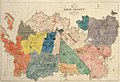 Map of Eden County shewing original sections and subdivisions thereof (c. 1914).jpg 1,999 × 1,373; 460 KB
-
 Waiau Survey District.jpg 3,922 × 5,183; 6 MB


_(14778182262).jpg)
.jpg)
