Category:20th-century maps of New Zealand
Jump to navigation
Jump to search
Countries of Oceania: Australia · Fiji · Kiribati · New Zealand · Papua New Guinea · Samoa · Solomon Islands · Tonga · Tuvalu · Vanuatu
Other areas: Hawaii – Partly: Indonesia
Other areas: Hawaii – Partly: Indonesia
Subcategories
This category has the following 7 subcategories, out of 7 total.
Media in category "20th-century maps of New Zealand"
The following 13 files are in this category, out of 13 total.
-
 Nlnzimage(2).jpg 1,080 × 1,667; 264 KB
-
 A map of New Zealand portraying her agricultural products & fisheries.jpg 10,283 × 7,122; 14.98 MB
-

-
 New Zealand - Her Natural and Industrial Resources Art.IWMPST16816.jpg 483 × 723; 186 KB
-
 Rongotai Aerodrome 1954 Landing chart.jpg 1,080 × 1,443; 149 KB
-
 Miramar-1959.png 851 × 866; 1.67 MB
-
 Atomic Bombing of Wellington City (9447363540).jpg 5,316 × 7,200; 3.47 MB
-
 Ngaroto railway station map.jpg 445 × 564; 210 KB
-
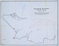
 North Island - Industrial Conciliation and Arbitration Act districts (17499483582).jpg 7,105 × 9,621; 7.19 MB
-
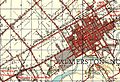 Palmerston North 1942 map.jpg 1,327 × 911; 784 KB
-
 Plan of Russell.jpg 1,031 × 816; 80 KB
-
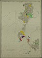 Porirua (9925286676).jpg 7,031 × 9,690; 3.23 MB
-
 Tapuata map 1943.jpg 1,352 × 1,172; 553 KB
.jpg)

.jpg)


.jpg)

.jpg)


.jpg)
