Category:1910s maps of Oceania
Jump to navigation
Jump to search
Temperate regions: North America · South America · Africa · Europe · Asia · Oceania – Polar regions: – Other regions:
Subcategories
This category has the following 8 subcategories, out of 8 total.
Media in category "1910s maps of Oceania"
The following 10 files are in this category, out of 10 total.
-
 Catalogue of Admiralty Charts 1914 Index Sheet 15 Western Pacific Islands and New Guinea.png 3,720 × 2,866; 4.88 MB
-
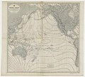
 Catalogue of Admiralty Charts 1914 Index Sheet 16 Central Pacific Islands.png 3,720 × 2,866; 5.11 MB
-
 FMIB 36466 Profondeurs du Pacifique en Polynesie Occidentale.jpeg 1,627 × 2,271; 989 KB
-
 FMIB 36758 Profondeurs du Pacifique au Sud du Japon.jpeg 1,597 × 2,177; 840 KB
-

-

-

-
 Oceania - btv1b8446123c.jpg 6,120 × 4,542; 3.93 MB
-
-


.jpg)