Category:1910s maps of Colombia
Jump to navigation
Jump to search
Subcategories
This category has only the following subcategory.
Media in category "1910s maps of Colombia"
The following 14 files are in this category, out of 14 total.
-

-
 Colombia (EB 1911).jpg 334 × 450; 122 KB
-
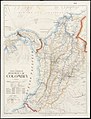
 EB1911 Colombia map.jpg 677 × 918; 356 KB
-
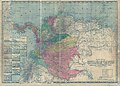
 Mapa comercial de la República de Colombia (14959847865).jpg 1,524 × 2,000; 2.76 MB
-
 Mapa de Colombia (1912 a).jpg 4,732 × 3,389; 9.56 MB
-
 Mapa de Colombia (1912).jpg 2,716 × 3,327; 5.61 MB
-
 Mapa de la Republica de Colombia LOC 2004629152.jpg 14,071 × 10,076; 24.53 MB
-
 Mapa de la Republica de Colombia LOC 2004629152.tif 14,071 × 10,076; 405.63 MB
-
 Mapa de la Republica de Colombia LOC 2012586811.jpg 8,220 × 10,068; 13.83 MB
-
 The American Museum journal (c1900-(1918)) (17539177504).jpg 1,814 × 2,568; 1.06 MB
-
 The American Museum journal (c1900-(1918)) (18161795485).jpg 2,848 × 1,996; 829 KB
-

-

-


.jpg)

.jpg)
.jpg)
.jpg)


)_(17539177504).jpg)
)_(18161795485).jpg)
_(20576658150).jpg)
_(20577900069).jpg)
.jpg)