Category:1910s maps of Belgium
Jump to navigation
Jump to search
Subcategories
This category has only the following subcategory.
Media in category "1910s maps of Belgium"
The following 17 files are in this category, out of 17 total.
-

-
 1911 Britannica - Map of Belgium and Luxemburg.png 920 × 682; 828 KB
-

-
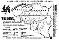 Carte des corps de volontaires de 1830.jpg 1,290 × 882; 213 KB
-

-
 (Map of World War I battle positions in the Bruges region, Belgium). LOC 80691199.jpg 14,562 × 8,026; 15.63 MB
-
 (Map of World War I battle positions in the Bruges region, Belgium). LOC 80691199.tif 14,562 × 8,026; 334.38 MB
-

-
 Unsere Front im Osten und Westen - page 1.jpg 13,997 × 10,766; 42.75 MB
-
 De LYser a LAisne, Acervo do Museu Paulista da USP.jpg 5,412 × 7,216; 35.23 MB
-

-
 Bartholomew's Map of North-Eastern France, Belgium and the Rhine - btv1b53121363d.jpg 9,550 × 7,294; 11.99 MB
-
 Deutsche Kriegszeitung (1914) 01 02 2.png 542 × 399; 306 KB
-
 German occupation of Belgium 1914-1916.jpg 886 × 775; 212 KB
-
 Guerre de 1914-1917-les destructions d'immeubles en Belgique. LOC 2012593517.jpg 4,800 × 3,704; 2.4 MB
-
 Guerre de 1914-1917-les destructions d'immeubles en Belgique. LOC 2012593517.tif 4,800 × 3,704; 50.87 MB
-

_(18198228632).jpg)

.jpg)

.jpg)
._LOC_80691199.jpg)
.jpg)


_(14783100192).jpg)

_01_02_2.png)


