
Category:1910s maps of the Philippines
- Provinces of the Philippines
- Province-level divisions (independent cities, Metro Manila)
Subcategories
This category has the following 2 subcategories, out of 2 total.
Media in category "1910s maps of the Philippines"
The following 8 files are in this category, out of 8 total.
-
 Sketch map of a lake district by Dr. Jose Rizal.png 369 × 445; 118 KB
-

-

-
 Bulletin of the Geological Society of America (1917) (20455692171).jpg 2,356 × 3,368; 1.5 MB
-
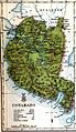 Cotabato 1918.jpg 677 × 1,168; 458 KB
-
 EB1911 Philippine Islands.jpg 1,780 × 2,489; 1.86 MB
-
 Map of the Philippines, 1910.jpg 3,000 × 4,208; 739 KB
-
 Peoples of the Philippines (1919) (14577373548).jpg 3,868 × 3,328; 858 KB


_(14781774571).jpg)
_(20455692171).jpg)


_(14577373548).jpg)