Category:1750s maps of India
Jump to navigation
Jump to search
Subcategories
This category has the following 2 subcategories, out of 2 total.
- 1752 maps of India (10 F)
Media in category "1750s maps of India"
The following 15 files are in this category, out of 15 total.
-
 Ville de Diu, ou Dio,1750.jpg 3,905 × 3,125; 1.41 MB
-
 IndiaMapBowen.jpg 6,000 × 4,968; 8.09 MB
-
 Coromandel Coast 1753.jpg 3,070 × 5,870; 3.62 MB
-
 1756 Bellin Map of Kollam Fort, Kerala, India - Geographicus - Coylan-bellin-1756.jpg 3,000 × 2,109; 2.09 MB
-
 Fort William, Calcutta.jpg 5,312 × 2,988; 4.54 MB
-
 Plan de Madras 1758 Bellin.jpg 2,312 × 994; 662 KB
-
-
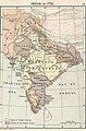
 AMH-8013-KB Map of the southern part of India.jpg 2,400 × 2,249; 1.01 MB
-
 AMH-8017-KB Map of Bengale.jpg 2,400 × 2,070; 1.05 MB
-
 AMH-8018-KB Map of North India.jpg 2,400 × 1,677; 945 KB
-
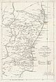
 Joppen map-India in 1751 published 1907 by Longmans.jpg 1,840 × 2,784; 1.52 MB
-
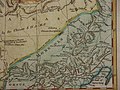
 Tartary1752nw.jpg 800 × 600; 139 KB
-
 Tartary1752se.jpg 800 × 600; 140 KB
-
 Tartary1752sw.jpg 800 × 600; 127 KB
-
 Tartaryeast1752sw.jpg 800 × 600; 159 KB


_-_Geographicus_-_IndiaEast-lerouge-1759.jpg)


