
Category:1790s maps of India
Subcategories
This category has the following 2 subcategories, out of 2 total.
- 1794 maps of India (3 F)
- 1799 maps of India (2 F)
Media in category "1790s maps of India"
The following 14 files are in this category, out of 14 total.
-

-
 Plan of the Carnatic and Mysore June 5th 1791 (BM 1869,0508.360).jpg 2,026 × 2,500; 715 KB
-
 Map of India, by Robert Wilkinson, London, 1 December 1791.png 1,500 × 1,846; 4.8 MB
-
-

-

-
 1793 Faden Wall Map of India - Geographicus - India-faden-1793.jpg 6,000 × 7,229; 9.83 MB
-
 Gulf of Cambay From a map by Gilles Robert de Vaugondy, 1793.jpg 800 × 600; 166 KB
-
 Map of India, by Robert Wilkinson, London, 1 January 1794.png 2,408 × 3,000; 14.86 MB
-
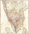
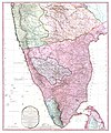
 South India Map 1794.jpg 3,400 × 4,608; 2.59 MB
-
 1800 Faden Rennell Wall Map of India - Geographicus - India-faden-1795.jpg 6,000 × 7,353; 10.85 MB
-
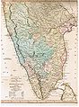
 1800 Map of Peninsular India-1795.jpg 5,936 × 7,137; 50.39 MB
-
 Asia1799.jpg 16,229 × 7,031; 44.52 MB
-
 Northern India 1794.png 13,173 × 13,396; 201 MB

.jpg)


