Category:1740s maps of India
Jump to navigation
Jump to search
Subcategories
This category has the following 4 subcategories, out of 4 total.
- 1740 maps of India (3 F)
- 1744 maps of India (3 F)
- 1746 maps of India (4 F)
- 1748 maps of India (3 F)
Media in category "1740s maps of India"
The following 4 files are in this category, out of 4 total.
-
 South Asia, 1744.jpg 6,453 × 5,161; 7.02 MB
-
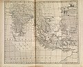
 1748 Homann Heirs Map of India and Southeast Asia - Geographicus - India-hmhr-1748.jpg 4,354 × 5,000; 8.23 MB
-
 Gulf of Cambay From an atlas by De Vaugondy, Paris, 1749.jpg 900 × 760; 525 KB
-
 Carte des Côtes de Malabar et de Coromandel (MAPS 81).jpg 7,140 × 5,596; 7.97 MB


.jpg)