
Category:1700s maps of India
Media in category "1700s maps of India"
The following 10 files are in this category, out of 10 total.
-
 1705 map - Carte des Indes et de la Chine.jpg 16,281 × 15,523; 49.69 MB
-

-
 Map of Tibet 1706 ( Thibet or Trorbrot ) and India (cropped).jpg 550 × 747; 93 KB
-
 1706 de la Feuille Map of Asia - Geographicus - Asia-lafeuille-1706.jpg 2,268 × 1,669; 728 KB
-

-
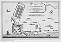
 Cranganor, Plan de la forteresse de Cranganor. 1709.jpg 4,363 × 2,981; 4.76 MB
-
 Cranganore.jpg 872 × 603; 108 KB
-
 A large draught of the MALLABAR COAST from bassalore to cape comaroone NYPL1640646.tiff 7,230 × 5,428; 112.28 MB
-
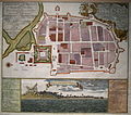 Historic map Tranquebar.JPG 2,356 × 2,077; 1.98 MB
-
 India, or the Mogul's Empire (NYPL b15373374-1505146).tiff 4,656 × 6,299; 83.93 MB


_and_India_(cropped).jpg)


