Category:1750s maps of Russia
Jump to navigation
Jump to search
Countries of Asia: People's Republic of China · Egypt‡ · Georgia‡ · India · Indonesia‡ · Iran · Japan · Lebanon · Philippines · Russia‡ · Syria · Turkey‡
Limited recognition: Taiwan · State of Palestine
‡: partly located in Asia
Limited recognition: Taiwan · State of Palestine
‡: partly located in Asia
Countries of Europe: Albania · Austria · Belgium · Croatia · Denmark · Estonia · France‡ · Georgia‡ · Germany · Greece · Hungary · Republic of Ireland · Italy · Latvia · Lithuania · Netherlands‡ · Norway · Poland · Portugal‡ · Romania · Russia‡ · Slovenia · Spain‡ · Sweden · Switzerland · Turkey‡ · Ukraine
‡: partly located in Europe
‡: partly located in Europe
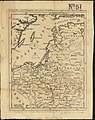
Media in category "1750s maps of Russia"
The following 15 files are in this category, out of 15 total.
-
 1750 Pocrovsky sobor.jpeg 3,135 × 2,480; 4.48 MB
-

-
 Ryzlei 1755.png 790 × 408; 558 KB
-
-
 Спасский собор на плане Хлынова.png 531 × 584; 798 KB
-
 Carte Des Nouvelles Decouvertes Au Nord de la Mer de Sud 1750.jpg 2,564 × 1,900; 5.46 MB
-
 Greatbukharanw.jpg 800 × 600; 120 KB
-
 Map of Siberia.jpg 1,717 × 1,555; 838 KB
-
 Plan Pskov 1750.jpg 3,200 × 2,237; 1.18 MB
-
 Russiaeuropean.jpg 737 × 587; 120 KB
-
 Siberia2ne.jpg 800 × 600; 162 KB
-
 Siberia2nw.jpg 800 × 600; 166 KB
-
 Siberia2se.jpg 800 × 600; 174 KB
-
 Siberia2sw.jpg 800 × 600; 173 KB
-
 Siberiawest.jpg 1,458 × 981; 434 KB


.jpg)


