Category:1560s maps of the world
Jump to navigation
Jump to search
| 16th-century maps of the world: ← 1500s 1510s 1520s 1530s 1540s 1550s 1560s 1570s 1580s 1590s → |
English: This category is supposed to hold world maps created in the 1560s.
Subcategories
This category has the following 4 subcategories, out of 4 total.
M
Media in category "1560s maps of the world"
The following 24 files are in this category, out of 24 total.
-
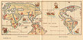
 "Orbis Descriptio" (two hemispheres) eastern.jpg 800 × 600; 130 KB
-
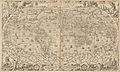
 Carta marina nuova tavola. LOC 84696977.tif 3,775 × 2,898; 31.3 MB
-
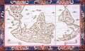
 Ruscelli Orbis Descriptio 1561 UTA.jpg 2,451 × 1,702; 4.13 MB
-
 Kyivstar vkraina 1561.jpg 2,500 × 1,896; 2.9 MB
-
 1562 world map by Paolo Forlani.jpg 15,311 × 10,544; 38.68 MB
-
 1565 Ferrando Bertelli map of the known world.jpg 9,801 × 6,029; 23.26 MB
-
 Desliens-1566.jpg 2,719 × 1,319; 5.23 MB
-
 Nicolas Desliens Map (1566).jpg 2,496 × 1,504; 1.23 MB
-
 Nicolas Desliens1.JPG 12,340 × 7,358; 15.74 MB
-
 World Map in two Hemispheres (Bonne Projection), 1566.jpg 13,992 × 9,469; 64.72 MB
-
 World RMG C4575.tiff 4,790 × 2,880; 39.47 MB
-
 Bartolomeu Velho 1568.jpg 3,255 × 2,402; 6.21 MB
-
 Bodleian Libraries, Ptolemy, the oikumene, or known World.jpg 1,000 × 675; 198 KB
-
 Carta marina nuova tavola. LOC 84696977.jpg 3,775 × 2,898; 1.66 MB
-

-

-
 Houghton 51-2493 - Cosmographia universale et exactissima, 1569.jpg 2,341 × 1,410; 1.67 MB
-
 Mappemonde de Ptolémée.png 983 × 527; 1.22 MB
-
 Old-world-map.jpg 1,599 × 919; 434 KB
-
 Orbis Terræ Compendiosa Descriptio, World Map, Mercator, 1569.jpg 1,483 × 815; 572 KB
-
 Ortelius1564 PATALIS1.jpg 1,566 × 1,503; 357 KB
-
 UBBasel Map 1565 Kartenslg AA 2 terra.tiff 13,493 × 9,868, 2 pages; 380.97 MB
-

-
 World map 1564 (Abraham Ortelius).jpg 13,778 × 8,052; 88.14 MB
_eastern.jpg)


.jpg)

,_1566.jpg)


.jpg)