Category:1500s maps of the world
Jump to navigation
Jump to search
| 16th-century maps of the world: ← 1500s 1510s 1520s 1530s 1540s 1550s 1560s 1570s 1580s 1590s → |
English: This category is supposed to hold world maps created in the 1500s.
Subcategories
This category has the following 8 subcategories, out of 8 total.
1
- King–Hamy Planisphere (1 F)
C
- Cantino map (42 F)
- Caverio map (5 F)
H
- Hunt–Lenox Globe (10 F)
M
- Map of Juan de la Cosa (38 F)
P
- Pesaro planisphere (2 F)
W
- Waldseemüller globe (8 F)
Media in category "1500s maps of the world"
The following 22 files are in this category, out of 22 total.
-
 1500 map by Juan de la Cosa Compass rose.jpg 2,022 × 2,022; 1.01 MB
-
 1500 map by Juan de la Cosa rotated.jpg 2,127 × 1,163; 1.29 MB
-
 1500 map by Juan de la Cosa.jpg 1,163 × 2,127; 3.33 MB
-
 1500MapAmericasNHMDF.JPG 3,872 × 2,592; 2.8 MB
-
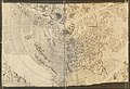
 1500s Kunstmann II Portolan.jpg 14,036 × 12,313; 28.17 MB
-

-
 1506 carta kunstmann (mapa mundi) 02.jpg 2,560 × 1,920; 2.04 MB
-
 A Map of the world 1506.tif 5,137 × 7,652; 112.48 MB
-
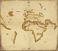
 1506 Contarini-Roselli World Map.jpg 14,083 × 9,590; 22.83 MB
-
 Waldseemüller world map 1508.jpg 1,495 × 831; 707 KB
-
 1507 Waldseemüller map.tif 19,660 × 11,200; 630 MB
-
 Rosselli 1508.jpg 1,024 × 768; 397 KB
-
 Barckhusen Vespucci.png 726 × 907; 1.13 MB
-
 Ca. 1505 T and O map by Zacharias Lilius (cropped).jpg 2,791 × 3,924; 822 KB
-
 Ca. 1505 T and O map by Zacharias Lilius.jpg 6,084 × 4,309; 2.38 MB
-
 Cantino planisphere 1502.jpg 1,280 × 601; 206 KB
-
 Carte ancienne projection Lambert.jpg 1,804 × 1,332; 1.97 MB
-
 Caverio Map circa 1506.jpg 6,634 × 3,450; 9.59 MB
-
 NIST To Preserve 1507 Map. America's 'Birth Certificate' (5941063784).jpg 2,475 × 1,811; 2.71 MB
-
 NIST to Preserve 1507 Map. America's 'Birth Certificate' (5941085614).jpg 1,500 × 833; 983 KB
-

-


.jpg)
_02.jpg)


.jpg)


.jpg)
.jpg)
