Category:1510s maps of the world
Jump to navigation
Jump to search
| 16th-century maps of the world: ← 1500s 1510s 1520s 1530s 1540s 1550s 1560s 1570s 1580s 1590s → |
English: This category is supposed to hold world maps created in the 1510s.
Subcategories
This category has the following 3 subcategories, out of 3 total.
Media in category "1510s maps of the world"
The following 30 files are in this category, out of 30 total.
-
 (World map) - Norman B. Leventhal Map Center at the BPL.jpg 2,000 × 1,515; 2.86 MB
-
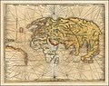
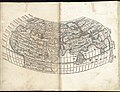
 1511 cordiform world map by Bernardo Silvano.tif 6,304 × 4,669; 84.23 MB
-
 Sylvanus map 1511.jpg 2,500 × 1,891; 1.53 MB
-
 1513 map of the world by Martin Waldseemüller.jpg 14,318 × 11,352; 23.66 MB
-
 1513 map - Orbis Typus Universalis Iuxta Hydrographorum Traditionem.jpg 14,500 × 11,321; 32.31 MB
-

-
 1513 Ptolemaic world map by Martin Waldseemüller.jpg 13,720 × 10,563; 23.08 MB
-
 1513 Ptolemaic world map.tif 6,862 × 5,353; 105.12 MB
-
 1514 Cornelius Aurelius completo alta-res.jpg 5,047 × 3,946; 3.54 MB
-
-

-
 1516 map of the world by Martin Waldseemüller.tif 19,696 × 11,145; 628.05 MB
-

-

-
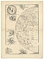
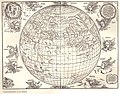 Durer Stabiussche Weltkarte 1515.jpg 4,223 × 3,306; 1.69 MB
-
 Durer Stabiussche Weltkarte World Map 1515.jpg 4,902 × 3,780; 2.32 MB
-
 Hieronymus Marini 1512.jpg 2,000 × 1,616; 1.2 MB
-
 Kunstmann IV Compass rose.jpg 3,300 × 3,300; 1.43 MB
-
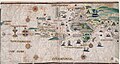 Kunstmann IV.jpg 10,507 × 5,613; 3.4 MB
-
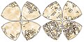
 Leonardo da Vinci Globe Gores.png 1,200 × 736; 285 KB
-
 Leonardo da Vinci’s Mappamundi.jpg 1,083 × 551; 390 KB
-
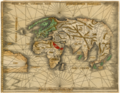
 Maggiolo Africa, Asia, Europe, and the northeast extremity of the New World.jpg 8,801 × 6,251; 9.76 MB
-
 Map of the Entire World WDL2833.png 7,200 × 5,600; 85.71 MB
-
 Orbis Typus Universalis Juxta Hydrographorum Traditionem. RMG F1973.tiff 7,196 × 5,230; 107.67 MB
-

-
 The World (7537876580).jpg 2,000 × 1,529; 3.15 MB
-

-

-

-
 World map (7537890064).jpg 2,000 × 1,501; 3.23 MB
_-_Norman_B._Leventhal_Map_Center_at_the_BPL.jpg)


_de_Jean_Stabius,_1515_(Reproduction_en_fac-simil%C3%A9)_-_btv1b53025194f_(1_of_2).jpg)
.jpg)
.jpg)
_(14595899759).jpg)


_de_Jean_Stabius,_1515_(Reproduction_en_fac-simil%C3%A9)_-_btv1b53025194f_(2_of_2).jpg)
.jpg)
.jpg)


.jpg)