Category:1520s maps of the world
Jump to navigation
Jump to search
| 16th-century maps of the world: ← 1500s 1510s 1520s 1530s 1540s 1550s 1560s 1570s 1580s 1590s → |
English: This category is supposed to hold world maps created in the 1520s.
Subcategories
This category has the following 3 subcategories, out of 3 total.
E
P
- Propaganda Map (22 F)
Media in category "1520s maps of the world"
The following 28 files are in this category, out of 28 total.
-

-

-
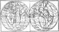 Monachus 1527 globe map 01.png 1,804 × 976; 1.43 MB
-
 Monachus 1527 globe map 02.png 953 × 473; 1.2 MB
-
 Monachus 1527 globe map 03.jpg 584 × 460; 144 KB
-
 Monachus 1527 globe map 05.png 1,015 × 731; 1.43 MB
-
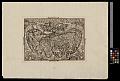
 RAINAUD(1893) Fig. 22. Le globe du moine François (1526-1530).jpg 1,633 × 945; 411 KB
-
 Ca. 1520 World Map of Pomponius Mela.jpg 12,980 × 10,096; 36.14 MB
-

-
 Castiglione Map.png 2,820 × 866; 3.65 MB
-
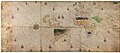
 Geocarta Nautica Universale (color).png 1,396 × 593; 1.57 MB
-
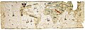
 Geocarta Nautica Universale.jpg 25,332 × 11,006; 54.14 MB
-
 Juan Vespucci 1526.jpg 10,824 × 3,867; 4.79 MB
-
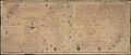 Map Diego Ribero 1529.jpg 4,048 × 1,736; 4.64 MB
-
 Map of Turin 1523 Compass rose.jpg 1,500 × 1,500; 262 KB
-
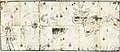
 Map of Turin 1523.jpg 14,298 × 6,261; 3.94 MB
-
 PietroCoppo.jpg 2,000 × 1,485; 4.09 MB
-
 Planisferio Salviati.jpg 1,941 × 875; 416 KB
-
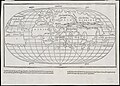
 Salviati Planisphere.jpg 736 × 371; 63 KB
-

-

-
 THE WORLD MAP, 1524 (and 1564) by Petrus Apianus.jpg 1,024 × 743; 213 KB
-

-
 Totius Orbis Descriptio tam Veterum quam Recentium Geographorum 1524.jpg 2,400 × 1,784; 773 KB
-
 UBBasel Map 1520 Kartenslg AA 1.tif 12,913 × 8,751, 2 pages; 323.33 MB
-
 Weimar 1527.png 22,881 × 9,034; 312.34 MB
-
 Weltkarte mit Windbläsern.jpg 3,594 × 2,540; 8.63 MB
-
 World map (2674845313).jpg 2,000 × 1,436; 2.26 MB


_Fig._22._Le_globe_du_moine_Fran%C3%A7ois_(1526-1530).jpg)


.png)


,_a_woodblock_engraving_by_Petrus_Apianus_(1495-1552)_the_eastern_half.jpg)
,_a_woodblock_engraving_by_Petrus_Apianus_(1495-1552)_the_western_half.jpg)
_by_Petrus_Apianus.jpg)
que_-_Norman_B._Leventhal_Map_Center_at_the_BPL.jpg)


.jpg)