Category:1600s maps of the world
Jump to navigation
Jump to search
| 17th-century maps of the world: ← 1600s 1610s 1620s 1630s 1640s 1650s 1660s 1670s 1680s 1690s → |
English: This category is supposed to hold world maps created in the 1600s.
Subcategories
This category has the following 2 subcategories, out of 2 total.
K
S
- Shanhai Yudi Quantu (6 F)
Media in category "1600s maps of the world"
The following 32 files are in this category, out of 32 total.
-
 1590 1602 Nova Hondius.jpg 3,542 × 2,604; 4.16 MB
-
 *world map for navigation (1600).jpg 800 × 600; 148 KB
-
 Map of the World Hakluyt Vol I Adelaide.png 3,029 × 2,079; 11.27 MB
-
 Map of the World Hakluyt Vol I.png 3,097 × 2,141; 5.27 MB
-
 Wright–Molyneux Map.png 4,000 × 2,874; 20.04 MB
-
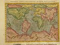
 1600 жылы Кёльн қаласында жарық көрген неміс картасындағы қазақтар (Kasakhi). Фрагмент.jpg 2,986 × 3,985; 3.69 MB
-
 Tipus Orbis Terrarum.jpg 11,986 × 8,529; 31.19 MB
-
 Nova totius terrarum orbis geographica ac hydrographica tabula RMG F0410.tiff 7,276 × 5,511; 114.72 MB
-
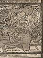
 1607 жылы Амстердамда жарық корген нидерланд картасындағы қазақтар (Caßackia). Фрагмент.jpg 3,240 × 4,142; 3.42 MB
-
 Designatio orbis christiani, 1607.jpg 3,815 × 2,991; 3.04 MB
-
 Hall Another World and Yet the Same 1607 Cornell CUL PJM 1009 01.jpg 6,371 × 6,026; 4.83 MB
-
 Map from Mundus alter et idem.jpg 250 × 216; 22 KB
-
 Atlas Minor Gerardi Mercatoris 1609 (106758437).jpg 5,852 × 4,650; 5.86 MB
-

-
 A map of the world c. 1600 Wellcome L0034555.jpg 3,426 × 2,655; 3.74 MB
-
 Bankoku zu. Chūka zu (IA bankokuzuchkazu00ricc).pdf 7,300 × 3,295; 3.16 MB
-
 Herrera y Tordesillas Descripcion de las Yndias Ocidentales 1601 UTA.jpg 4,362 × 3,270; 5.55 MB
-
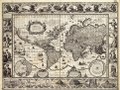
 Map of the world by Abraham Ortelius.jpeg 1,538 × 1,166; 582 KB
-
 Nansenbu Karte.jpg 550 × 691; 91 KB
-
 Nova-totius-terrarum-orbis-geographica-ac-hydrographica-tabula.jpg 3,639 × 2,504; 13.02 MB
-
 Typus orbis terrarum (NYPL b15404146-1632129).jpg 7,230 × 5,428; 6.36 MB
-
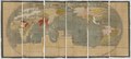
 The world from from Geographisch Handtbuch (north east).jpg 800 × 600; 205 KB
-
 The world from from Geographisch Handtbuch (north west).jpg 800 × 600; 183 KB
-
 The world from from Geographisch Handtbuch (south east).jpg 800 × 600; 207 KB
-
 The world from from Geographisch Handtbuch(north west).jpg 800 × 600; 200 KB
-
 The world from from Geographisch Handtbuch.jpg 800 × 600; 197 KB
-
 Totius Orbis Cogniti Universalis Descriptio 1605.jpg 4,122 × 2,521; 5.23 MB
-
 Typus orbis terrarum - Arnoldus F. ab Langren, auth. et scalp. - btv1b8490572r.jpg 7,426 × 5,028; 7.64 MB
-
 Typus Orbis Terrarum Ad Imitationem Universalis Gerhardi Mercatoris.jpg 8,156 × 5,854; 15.25 MB
-
 Typus orbis terrarum. NYPL1632129.tiff 7,230 × 5,428; 112.28 MB
-
 Universale Descrittione del Mondo, 1601, Arnoldo di Arnoldi.jpg 19,753 × 12,478; 89.53 MB
-
 Weltkarte-Japan.jpg 1,623 × 1,263; 683 KB

.jpg)


._%D0%A4%D1%80%D0%B0%D0%B3%D0%BC%D0%B5%D0%BD%D1%82.jpg)

._%D0%A4%D1%80%D0%B0%D0%B3%D0%BC%D0%B5%D0%BD%D1%82.jpg)


.jpg)
.jpg)


.jpg)
.jpg)
.jpg)
.jpg)
.jpg)


