Category:Old maps of the canton of Graubünden
Jump to navigation
Jump to search
Cantons of Switzerland: Aargau (AG) · Basel-Stadt (BS) · Basel-Landschaft (BL) · Bern (BE) · Fribourg (FR) · Geneva (GE) · Graubünden (GR) · Jura (JU) · Luzern (LU) · Schwyz (SZ) · Solothurn (SO) · St. Gallen (SG) · Thurgau (TG) · Ticino (TI) · Valais (VS) · Vaud (VD) · Zürich (ZH)
Media in category "Old maps of the canton of Graubünden"
The following 46 files are in this category, out of 46 total.
-

-
 UBBasel Map 1650 Kartenslg Schw B 169.tif 7,373 × 4,479, 2 pages; 94.5 MB
-
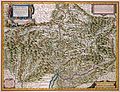
 Topographia Helvetiae, Rhaetiae et Valesiae 1654 (1127104).jpg 3,835 × 2,792; 4.19 MB
-

-
 CH-NB - Grafiken Orts- und Landschaftsansichten - GS-GRAF-ANSI-GR-29.tif 5,524 × 4,019; 63.53 MB
-
 1834 Keller Pocket Map of Switzerland - Geographicus - Switzerland-keller-1834.jpg 5,000 × 4,239; 8.18 MB
-

-

-

-
-
 Blaeu 1645 - Alpinæ seu fœderatæ Rhaetiae subditarumque ei terrarum nova descriptio.jpg 3,640 × 3,026; 1.79 MB
-
 BorderSituationFinstermuenzDufour.jpg 723 × 694; 512 KB
-
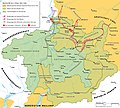 Bündner Wirren Phase 2.jpg 2,500 × 2,250; 3.34 MB
-
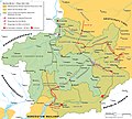 Bündner-Wirren Phase1.jpg 2,500 × 2,250; 3.34 MB
-
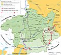 Bündner-Wirren-Phase-3.jpg 2,500 × 2,250; 2.15 MB
-
 Churraetien.png 2,500 × 2,160; 1.06 MB
-
 Drei Bünde Karte 1768.jpg 5,184 × 3,888; 5.95 MB
-
 General map to illustrate Italian Alps (c 1875).jpg 4,240 × 3,125; 5.47 MB
-
 Geschichte Graubuenden.png 2,000 × 1,873; 504 KB
-
 GLS Oberalp.jpg 1,360 × 720; 238 KB
-
 GLS Quellgebiet Vorderrhein.png 825 × 1,557; 577 KB
-
 Herrschaften Graubuenden.png 2,500 × 2,312; 1.05 MB
-
 Karte Oberengadin Lechner 1858.jpg 3,693 × 4,483; 9.82 MB
-
 Karte Stumpf 1548 markiert.png 1,466 × 2,348; 7.85 MB
-
 Karte Stumpf 1548.png 1,466 × 2,348; 7.85 MB
-
 Klosters Silvretta 1927.jpg 1,600 × 968; 445 KB
-
 La-Repubblica-delleTre-Legh-es.svg 926 × 726; 1.89 MB
-
 La-Repubblica-delleTre-Legh.png 2,000 × 1,866; 772 KB
-
 Map of the Grisons (Graubünden) divided in its Leagues, 1718.jpg 856 × 1,000; 324 KB
-
 Reisekarte des Kantons Graubünden - btv1b8460154m.jpg 6,896 × 5,472; 5.39 MB
-
 Rhaetiae et Valtolinae desc. - N. Geelkerk exc. - btv1b8444257w.jpg 9,164 × 6,704; 11.87 MB
-
 Sbahrhaffte Verzeichnus des Brattigöws ... - btv1b530426726.jpg 4,192 × 3,428; 3.26 MB
-
 Sbahrhaffte Verzeichnus des Brattigöws ... - H.C. Gyger defig. - btv1b53042387q.jpg 4,387 × 3,466; 3.83 MB
-
 Swisstopo Dufourkarte BLATT XIV. ALTORF CHUR LT TK 014 1859.tiff 11,680 × 8,600; 95.82 MB
-
 Swisstopo Dufourkarte BLATT XIX BELLINZONA CHIAVENNA LT TK 019 1858.tiff 11,786 × 8,600; 96.69 MB
-
 Swisstopo Dufourkarte BLATT XV DAVOS MARTINSBRUCK LT TK 015 1853.tiff 11,786 × 8,600; 96.69 MB
-
 Swisstopo Dufourkarte BLATT XX SONDRIO BORMIO LT TK 020 1854.tiff 11,680 × 8,600; 95.82 MB
-
-
 UBBasel Map 1534 Kartenslg AA 128.tif 6,267 × 4,117, 2 pages; 137.34 MB
-
 UBBasel Map Graubünden Rätische Alpen Veltlin 1620-1640 Kartenslg Schw Cp 8.tif 10,136 × 7,121, 2 pages; 206.53 MB
-
 UBBasel Map Graubünden Rätische Alpen Veltlin 1630-1639 Kartenslg Schw Cp 9.tif 11,877 × 9,142, 2 pages; 310.67 MB
-
 UBBasel Map Graubünden Rätische Alpen Veltlin 1663 Kartenslg Schw Cp 9a.tif 11,210 × 8,677, 2 pages; 555.36 MB
-
 UBBasel Map Graubünden Rätische Alpen Veltlin 1670-1690 Kartenslg Schw Cp 10.tif 11,671 × 9,264, 2 pages; 309.36 MB
-
 Valtellina by Jaillot 1717.png 1,920 × 1,080; 4.82 MB
-
 Valtellina by Walser, 1768.png 1,920 × 1,080; 4.67 MB
-
 Wachstum der Buende.png 2,500 × 2,232; 1.04 MB
.jpg)
.jpg)


%27_(11215933486).jpg)


.jpg)


_divided_in_its_Leagues,_1718.jpg)


_(14781451154).jpg)


