Category:Old maps of the canton of Lucerne
Jump to navigation
Jump to search
Cantons of Switzerland: Aargau (AG) · Basel-Stadt (BS) · Basel-Landschaft (BL) · Bern (BE) · Fribourg (FR) · Geneva (GE) · Graubünden (GR) · Jura (JU) · Luzern (LU) · Schwyz (SZ) · Solothurn (SO) · St. Gallen (SG) · Thurgau (TG) · Ticino (TI) · Valais (VS) · Vaud (VD) · Zürich (ZH)
Media in category "Old maps of the canton of Lucerne"
The following 7 files are in this category, out of 7 total.
-
 France militaire 1836 TIII 157015.jpg 2,893 × 2,124; 1.11 MB
-
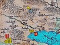 Cysat Waegmann Karte Huwyler Huwyl.jpg 486 × 365; 311 KB
-
 Huwyl Burg Castle by 1665 Hans Conrad Gyger Map.jpg 1,000 × 661; 486 KB
-
 Huwyl Burg Castle Römerswyl.JPG 553 × 337; 225 KB
-
 Swisstopo Dufourkarte BLATT VIII. AARAU LUZERN ZUG ZÜRICH LT TK 008 1861.tiff 11,680 × 8,600; 95.82 MB
-
 UBBasel Map 1600-1699 Kartenslg Schw B 28a Lucern.tiff 9,854 × 5,509, 2 pages; 155.34 MB
-
 Wägemann Karte von 1614 (Ausschnitt Seetal).jpg 794 × 534; 920 KB


.jpg)