Category:Old maps of the canton of Basel-Landschaft
Jump to navigation
Jump to search
Cantons of Switzerland: Aargau (AG) · Basel-Stadt (BS) · Basel-Landschaft (BL) · Bern (BE) · Fribourg (FR) · Geneva (GE) · Graubünden (GR) · Jura (JU) · Luzern (LU) · Schwyz (SZ) · Solothurn (SO) · St. Gallen (SG) · Thurgau (TG) · Ticino (TI) · Valais (VS) · Vaud (VD) · Zürich (ZH)
Subcategories
This category has only the following subcategory.
O
Media in category "Old maps of the canton of Basel-Landschaft"
The following 5 files are in this category, out of 5 total.
-
 Karte des Deutschen Reiches (5820669c).jpg 12,345 × 9,263; 55.19 MB
-
 Karte des Deutschen Reiches (5820656c).jpg 12,248 × 9,238; 53.11 MB
-
 Karte des Deutschen Reiches (5820657c).jpg 12,254 × 9,267; 54.04 MB
-
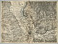
 UBBasel Map 1680-1700 Kartenslg Schw Cl 74 Hersberg.tiff 8,798 × 7,179, 2 pages; 180.73 MB
-
 UBBasel Map 1750 Kartenslg Schw Cl 86a Waldenburg.tiff 5,005 × 4,207, 2 pages; 60.27 MB
.jpg)
.jpg)
.jpg)