Category:Old maps of the canton of Thurgau
Jump to navigation
Jump to search
Cantons of Switzerland: Aargau (AG) · Basel-Stadt (BS) · Basel-Landschaft (BL) · Bern (BE) · Fribourg (FR) · Geneva (GE) · Graubünden (GR) · Jura (JU) · Luzern (LU) · Schwyz (SZ) · Solothurn (SO) · St. Gallen (SG) · Thurgau (TG) · Ticino (TI) · Valais (VS) · Vaud (VD) · Zürich (ZH)
Media in category "Old maps of the canton of Thurgau"
The following 15 files are in this category, out of 15 total.
-

-
 22481152-maximum.jpg 7,498 × 5,366; 2.1 MB
-
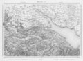
 6526410-maximum Sulzberger1838.jpg 11,451 × 9,174; 29.55 MB
-
 Bahnlinie-Konstanz-Rorschach-Karte.jpg 10,116 × 5,884; 15.96 MB
-
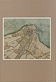
 FrauenfeldPlan1771.jpg 5,142 × 2,860; 5.73 MB
-
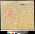
 Grundriss der Stadt Frauenfeld.jpg 14,996 × 24,595; 14.86 MB
-
 Karte Arbon 1768.jpg 3,975 × 5,842; 2.6 MB
-
 Karte des Deutschen Reiches (5820658c).jpg 12,340 × 9,388; 52.18 MB
-
 Karte des Deutschen Reiches (5820659c).jpg 12,322 × 9,388; 50.78 MB
-
 Karte des Deutschen Reiches (5820660c).jpg 12,368 × 9,300; 47.04 MB
-
 Karte des Deutschen Reiches von 1893 (659) Konstanz.jpg 12,322 × 9,388; 32.41 MB
-
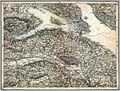
 Karte Fuerstabtei SanktGallen.jpg 1,360 × 1,094; 1.69 MB
-
 Situationsplan der Gemeinde Arbon.jpg 10,561 × 10,308; 25.3 MB
-
 Sulzbergkarte Frauenfeld.jpg 2,521 × 2,123; 1.29 MB
-
 Swisstopo Dufourkarte BLATT IV. FRAUENFELD ST.GALLEN LT TK 004 1850.tiff 11,802 × 8,600; 96.82 MB
.jpg)


.jpg)
.jpg)
.jpg)
_Konstanz.jpg)


