Category:Maps of the canton of Graubünden
Jump to navigation
Jump to search
Cantons of Switzerland: Aargau (AG) · Appenzell Ausserrhoden (AR) · Appenzell Innerrhoden (AI) · Basel-Stadt (BS) · Basel-Landschaft (BL) · Bern (BE) · Fribourg (FR) · Geneva (GE) · Glarus (GL) · Graubünden (GR) · Jura (JU) · Luzern (LU) · Neuchâtel (NE) · Nidwalden (NW) · Obwalden (OW) · Schaffhausen (SH) · Schwyz (SZ) · Solothurn (SO) · St. Gallen (SG) · Thurgau (TG) · Ticino (TI) · Uri (UR) · Valais (VS) · Vaud (VD) · Zug (ZG) · Zürich (ZH)
Subcategories
This category has the following 51 subcategories, out of 51 total.
Media in category "Maps of the canton of Graubünden"
The following 79 files are in this category, out of 79 total.
-
 Kanton Graubünden Burgen und Schlösser.png 3,497 × 2,692; 11.4 MB
-
 Karte Kanton Graubünden 2016.png 2,066 × 1,646; 762 KB
-
 Karte Kanton Graubünden Regionen 2016.png 1,476 × 1,176; 615 KB
-
 1156 Schesaplana.jpg 14,000 × 9,600; 130.71 MB
-
 1157 Sulzfluh.jpg 14,000 × 9,600; 123.24 MB
-
 1159 Ischgl.jpg 14,000 × 9,600; 128 MB
-
 1174 Elm.jpg 14,000 × 9,600; 134.49 MB
-
 1175 Vättis.jpg 14,000 × 9,600; 134.39 MB
-
 1176 Schiers.jpg 14,000 × 9,600; 118.76 MB
-
 1177 Serneus.jpg 14,000 × 9,600; 124.32 MB
-
 1178 Gross Litzner.jpg 14,000 × 9,600; 127.5 MB
-
 1179 Samnaun.jpg 14,000 × 9,600; 125.75 MB
-
 1192 Schächental.jpg 14,000 × 9,600; 133.61 MB
-
 1193 Tödi.jpg 14,000 × 9,600; 131.02 MB
-
 1194 Flims.jpg 14,000 × 9,600; 117.67 MB
-
 1195 Reichenau.jpg 14,000 × 9,600; 119.43 MB
-
 1196 Arosa.jpg 14,000 × 9,600; 117.23 MB
-
 1197 Davos.jpg 14,000 × 9,600; 122.34 MB
-
 1198 Silvretta.jpg 14,000 × 9,600; 128.73 MB
-
 1199 Scuol.jpg 14,000 × 9,600; 123.42 MB
-
 1212 Amsteg.jpg 14,000 × 9,600; 141.95 MB
-
 1213 Trun.jpg 14,000 × 9,600; 128.64 MB
-
 1214 Ilanz.jpg 14,000 × 9,600; 118.11 MB
-
 1215 Thusis.jpg 14,000 × 9,600; 124.94 MB
-
 1216 Filisur.jpg 14,000 × 9,600; 123.82 MB
-
 1217 Scalettapass.jpg 14,000 × 9,600; 126.9 MB
-
 1218 Zernez.jpg 14,000 × 9,600; 131.35 MB
-
 1219 S-charl.jpg 14,000 × 9,600; 126.06 MB
-
 1232 Oberalppass.jpg 14,000 × 9,600; 135.96 MB
-
 1233 Greina.jpg 14,000 × 9,600; 137.29 MB
-
 1234 Vals.jpg 14,000 × 9,600; 127.2 MB
-
 1235 Andeer.jpg 14,000 × 9,600; 121.74 MB
-
 1236 Savognin.jpg 14,000 × 9,600; 118.84 MB
-
 1237 Albulapass.jpg 14,000 × 9,600; 128.23 MB
-
 1238 Piz Quattervals.jpg 14,000 × 9,600; 127.36 MB
-
 1239 Sta. Maria.jpg 14,000 × 9,600; 122.49 MB
-
 1253 Olivone.jpg 14,000 × 9,600; 135.51 MB
-
 1254 Hinterrhein.jpg 14,000 × 9,600; 132.66 MB
-
 1255 Splügenpass.jpg 14,000 × 9,600; 124.49 MB
-
 1256 Bivio.jpg 14,000 × 9,600; 121.91 MB
-
 1257 St. Moritz.jpg 14,000 × 9,600; 127.76 MB
-
 1258 La Stretta.jpg 14,000 × 9,600; 118.51 MB
-
 1274 Mesocco.jpg 14,000 × 9,600; 142 MB
-
 1275 Campodolcino.jpg 14,000 × 9,600; 128.59 MB
-
 1276 Val Bregaglia.jpg 14,000 × 9,600; 129.82 MB
-
 1277 Piz Bernina.jpg 14,000 × 9,600; 130.48 MB
-
 1278 La Rösa.jpg 14,000 × 9,600; 129.26 MB
-
 1294 Grono.jpg 14,000 × 9,600; 144.02 MB
-
 1296 Sciora.jpg 14,000 × 9,600; 132.33 MB
-
 1298 Lago di Poschiavo.jpg 14,000 × 9,600; 131.83 MB
-
 1314 Passo San Jorio.jpg 14,000 × 9,600; 137.14 MB
-
 2180 Samnaun Ost.jpg 5,412 × 9,600; 45.9 MB
-
 2200 Piz Lad.jpg 14,000 × 9,600; 110.63 MB
-
 2240 Müstair.jpg 14,000 × 9,600; 120.91 MB
-
 Baliaggi-transalpini rev.png 1,500 × 1,516; 572 KB
-
 Cresta Run Map.png 7,002 × 4,954; 8.96 MB
-
 DreiBuende Einteilung.png 900 × 643; 29 KB
-
 ETH-BIB-Maloja-Wasserscheide-Dia 247-Z-00113.tif 2,899 × 3,445; 28.71 MB
-
 Fraktionsgemeinden Landschaft Davos.png 696 × 630; 31 KB
-
 Italian Graubünden.png 1,003 × 716; 12 KB
-
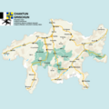
 KARTE albulabahn.png 1,024 × 758; 459 KB
-
 Karte Calanda.png 1,062 × 834; 335 KB
-
 Karte der S-Bahn Chur.svg 467 × 405; 183 KB
-
 Karte Gemeinschaftsgebiet Maienfeld-Fläsch 1977.png 1,475 × 1,284; 403 KB
-
 Karte Weinbau Kanton Graubünden 2021.png 4,133 × 2,848; 3 MB
-
 Leuzinger Held Coaz Albulagebiet 1893.jpg 3,000 × 2,168; 1.3 MB
-
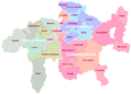
 Map Canton Graubuenden Bezirke.png 1,003 × 716; 173 KB
-
 Map of Grisons Switzerland.png 4,000 × 4,000; 1.75 MB
-
 Plan of the Cresta Run.jpg 865 × 713; 86 KB
-
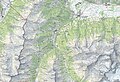
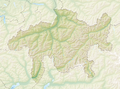 Reliefkarte Graubünden blank.png 4,384 × 3,252; 13.84 MB
-
 Streckenentwicklung zwischen Bergün und Preda.svg 1,414 × 2,377; 753 KB
-
 Swiss national map, 38 Panixerpass.jpg 14,000 × 9,600; 160.05 MB
-
 Swiss national map, 39 Flüelapass.jpg 14,000 × 9,600; 155.22 MB
-
 Swiss national map, 44 Passo del Maloja.jpg 14,000 × 9,600; 157.67 MB
-
 Switzerland Locator Map GR.svg 1,052 × 744; 213 KB
-

-

-
 Tre Leghe Grigioni.png 900 × 643; 26 KB
-
 DreiBuende Einteilung-notext.png 900 × 643; 22 KB


_(14597180368).jpg)
_(14783813935).jpg)

