Category:Georgia State Route 20
Jump to navigation
Jump to search
 | number: | (twenty-) |
|---|---|---|
| State highways in Georgia (U.S. state): | 1 · 2 · 3 · 4 · 5 · 6 · 7 · 8 · 9 · 10 · 11 · 12 · 13 · 14 · 15 · 16 · 17 · 18 · 19 · 20 · 21 · 22 · 23 · 24 · 25 · 26 · 27 · 28 · 29 · 30 · 31 · 32 · 33 · 34 · 35 · 36 · 37 · 38 · 39 · 40 |
State highway in northern Georgia   | |||||
| Upload media | |||||
| Instance of | |||||
|---|---|---|---|---|---|
| Location | Georgia | ||||
| Transport network | |||||
| Owned by | |||||
| Maintained by | |||||
| Inception |
| ||||
| Length |
| ||||
| |||||
English: State Route 20 (SR 20) is an abnormally-oriented route in roughly the shape of a capital J rotated ninety degrees to the left. Its counterclockwise terminus is at the Alabama state line in Floyd County, and its clockwise terminus occurs in the middle of an overpass over U.S. Route 19/U.S. Route 41 (US 19/US 41) and SR 3 in Hampton in Henry County at the Atlanta Motor Speedway, where it is known as Bruton Smith Parkway.
Subcategories
This category has only the following subcategory.
G
Media in category "Georgia State Route 20"
The following 31 files are in this category, out of 31 total.
-
 Georgia 20 Spur.svg 600 × 600; 12 KB
-
 DogwoodDrive-Int20ewGA20nsGA138ewOverheads (34346887391).jpg 2,400 × 1,600; 1.84 MB
-
 GA 20 and Lumpkin Hill, Rome, GA Mar 2018.jpg 3,456 × 2,304; 4 MB
-
 GA SR 20 in Corbin, Bartow County, April 2017.jpg 3,456 × 2,304; 4.51 MB
-
 GA SR 20 in snow storm, Dec 2017.jpg 3,264 × 2,448; 2.37 MB
-
 GA SR 20 just south of Conyers, GA..jpg 1,888 × 1,090; 610 KB
-
 GA SR 20 Spur, November 2021 1.jpg 4,032 × 2,268; 4.52 MB
-
 GA SR 20 Spur, November 2021 2.jpg 4,032 × 2,268; 4.51 MB
-
 GA20eUS27US411nGA101Signs-Rome (30929820320).jpg 2,400 × 1,600; 2.13 MB
-
 Georgia 20.svg 600 × 600; 6 KB
-
 Georgia I75sb Exit 218 .5 mile.jpg 5,184 × 3,456; 4.57 MB
-
 Georgia I75sb Exit 218 1 mile.jpg 5,184 × 3,456; 4.66 MB
-
 Georgia I75sb Exit 218.jpg 5,184 × 3,456; 4.3 MB
-
 Georgia I75sb Hampton-McDonough Rd overpass.jpg 5,184 × 3,456; 4.52 MB
-
 Georgia I985nb Buford Dr Overpass.jpg 5,184 × 3,456; 4.78 MB
-
 Georgia I985nb Exit 4 1 mile.jpg 5,184 × 3,456; 4.58 MB
-
 Georgia I985nb Exit 4 1.5 mile.jpg 5,184 × 3,456; 4.23 MB
-
 Georgia I985nb Exit 4.jpg 5,184 × 3,456; 4.04 MB
-
 Georgia I985sb Exit 4 .5 mile.jpg 5,184 × 3,456; 4.27 MB
-
 Georgia I985sb Exit 4 1 mile.jpg 5,184 × 3,456; 4.56 MB
-
 Georgia I985sb Exit 4.jpg 5,184 × 3,456; 4.95 MB
-
 Georgia I985sb GA20 US23 Buford Dr Overpass.jpg 5,184 × 3,456; 4.38 MB
-
 Georgia state route 20 map.png 822 × 477; 157 KB
-
 Int20eRoad-Exit82-GA20GA138Conyers (34477245975).jpg 2,400 × 1,600; 1.67 MB
-
 JCT sign for GA 20, GA 81 along GA 920 east.jpg 4,030 × 2,551; 1.68 MB
-
 Main Street, Loganville, Georgia May 2017.jpg 3,456 × 2,304; 3.59 MB
-
 McDonough.svg 651 × 704; 338 KB
-
 Overheads for state routes 20 and 140.jpg 1,632 × 1,232; 440 KB
-
 Sawnee Mountain viewed from Cumming.JPG 3,456 × 2,304; 3.9 MB
-
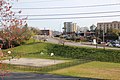
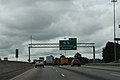
 US 19 US 41 GA 3 in Hampton, GA at the western terminus of GA 20.jpg 960 × 543; 63 KB
-
 US411 at US41 (30929824210).jpg 2,400 × 1,600; 2.49 MB

.jpg)


.jpg)


.jpg)


.jpg)