Category:Georgia State Route 11
Jump to navigation
Jump to search
 | number: | (eleven) |
|---|---|---|
| State highways in Georgia (U.S. state): | 1 · 2 · 3 · 4 · 5 · 6 · 7 · 8 · 9 · 10 · 11 · 12 · 13 · 14 · 15 · 16 · 17 · 18 · 19 · 20 · 21 · 22 · 23 · 24 · 25 · 26 · 27 · 28 · 29 · 30 · 31 |
State highway in central Georgia  | |||||
| Upload media | |||||
| Instance of | |||||
|---|---|---|---|---|---|
| Location | Georgia | ||||
| Transport network | |||||
| Owned by | |||||
| Maintained by | |||||
| Inception |
| ||||
| Length |
| ||||
| |||||
English: State Route 11 (SR 11) is a state highway in the US state of Georgia. It runs the entire length of the state from south at the Florida state line to north at the North Carolina state line, roughly bisecting the state into two equal pieces. It is the longest route in the state.
Subcategories
This category has the following 6 subcategories, out of 6 total.
B
G
I
Media in category "Georgia State Route 11"
The following 31 files are in this category, out of 31 total.
-
 Cleveland city limit GA11 NB.jpg 5,184 × 3,456; 9.33 MB
-
 Farmers Home Furniture, Perry.JPG 4,608 × 3,456; 5.18 MB
-
 Former Hawkinsville Hotel.JPG 5,152 × 3,864; 7.5 MB
-
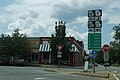 GA16 GA212 West GA11 GA83 South Signs - Monticello (41397977024).jpg 2,400 × 1,600; 2.07 MB
-
 Georgia 11.svg 600 × 600; 3 KB
-
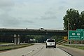
 Georgia I985nb GA11 Overpass.jpg 5,184 × 3,456; 4.61 MB
-
 Georgia I985sb Exit 22 GA11 Overpass.jpg 5,184 × 3,456; 4.56 MB
-
 Georgia state route 11 map.png 2,465 × 1,749; 1.01 MB
-
 Hamilton County border US129SB.JPG 5,152 × 3,864; 7.92 MB
-
 Hawkinsville city limits US341SB.JPG 5,152 × 3,864; 7.84 MB
-
 Hawkinsville Post Office.JPG 5,152 × 3,864; 7.91 MB
-
 Houston County border US341NB.JPG 5,152 × 3,864; 7.88 MB
-
 Houston County Fire Department 3.JPG 5,152 × 3,864; 7.81 MB
-
 Jefferson Davis historical marker, Abbeville.JPG 4,320 × 3,240; 4.51 MB
-
 Looking south down Grant St from NW corner of intersection with Central Ave.jpg 5,184 × 3,456; 6.76 MB
-
 Looking south down Grant St from SE corner of intersection with Central Ave.jpg 5,184 × 3,456; 8.43 MB
-
 Pulaski County border US341SB.JPG 5,152 × 3,864; 7.87 MB
-
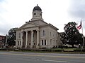
 Pulaski County Courthouse Northeast corner.JPG 5,152 × 3,864; 7.74 MB
-
 Pulaski County Courthouse Northwest corner.JPG 5,152 × 3,864; 7.94 MB
-
 Pulaski County Historical Marker.JPG 5,152 × 3,864; 7.85 MB
-
 Second Atlanta International Pop Festival marker, Peach County.JPG 5,184 × 3,456; 8 MB
-
 Slosheye Trail Historical Marker, Hawkinsville.JPG 5,152 × 3,864; 7.82 MB
-
 Street clock (Verdin), Perry School, Perry, Georgia.JPG 4,608 × 3,456; 5.29 MB
-
 Sun Mark Community Bank, Hawkinsville.JPG 5,152 × 3,864; 7.92 MB
-
 The Bank of Perry, Georgia.JPG 4,608 × 3,456; 4.29 MB
-
 US129NB GA254 Junc, Hall County.jpg 5,184 × 3,456; 4.88 MB
-
 US341,GA7JCTGA11 Bus.jpg 5,184 × 3,456; 4.26 MB
-
 US341,GA7JCTGA127.jpg 5,184 × 3,456; 4.01 MB
-
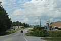
 US341sRoad-GA11GA26GA112US129Asigns-Hawkinsville (32868714516).jpg 2,400 × 1,600; 1.81 MB
-
 White County limit US129NB.jpg 5,184 × 3,456; 4.62 MB
-
 Wilcox County Library, Abbeville.JPG 4,320 × 3,240; 4.44 MB


.jpg)


,_Perry_School,_Perry,_Georgia.JPG)


.jpg)

