Category:Georgia State Route 18
Jump to navigation
Jump to search
 | number: | (eighteen) |
|---|---|---|
| State highways in Georgia (U.S. state): | 1 · 2 · 3 · 4 · 5 · 6 · 7 · 8 · 9 · 10 · 11 · 12 · 13 · 14 · 15 · 16 · 17 · 18 · 19 · 20 · 21 · 22 · 23 · 24 · 25 · 26 · 27 · 28 · 29 · 30 · 31 · 32 · 33 · 34 · 35 · 36 · 37 · 38 |
English: State Route 18 (SR 18) is a state highway that runs west-to-east through portions of Troup, Harris, Meriwether, Pike, Lamar, Monroe, Jones, Wilkinson, and Twiggs counties in the western and central parts of the U.S. state of Georgia. The route connects West Point, just east of Alabama state line, with Jeffersonville, via Barnesville.
State highway in central Georgia  | |||||
| Upload media | |||||
| Instance of | |||||
|---|---|---|---|---|---|
| Location | Georgia | ||||
| Transport network | |||||
| Owned by | |||||
| Maintained by | |||||
| Inception |
| ||||
| Length |
| ||||
| |||||
Subcategories
This category has only the following subcategory.
Media in category "Georgia State Route 18"
The following 16 files are in this category, out of 16 total.
-
 First Bank of Pike, Concord.jpg 5,184 × 3,456; 8.35 MB
-
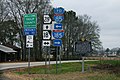 GA18 GA219 I-85 I-185 Signs (32093502173).jpg 2,400 × 1,600; 2.58 MB
-
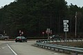 GA18eRoadSign-OffInt85n (32908262635).jpg 2,400 × 1,600; 1.57 MB
-
 Georgia 18.svg 600 × 600; 5 KB
-
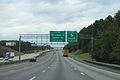 Georgia I75nb exit 185 .5 mile.jpg 5,184 × 3,456; 4.62 MB
-
 Georgia I75nb exit 185 1 mile.jpg 5,184 × 3,456; 4.02 MB
-
 Georgia I75sb Exit 185 .75 mile.jpg 5,184 × 3,456; 5.31 MB
-
 Georgia I75sb Exit 185.jpg 5,184 × 3,456; 4.9 MB
-
 Georgia I75sb Exit 186 .5 mile.jpg 5,184 × 3,456; 4.61 MB
-
 Georgia state route 18 map.png 891 × 435; 127 KB
-
 NRHP Plaque, 22 W Main St, Forsyth.JPG 4,608 × 3,456; 3.8 MB
-
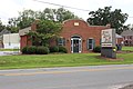
 Old Drug Store, Concord.jpg 5,184 × 3,456; 9.17 MB
-
 Prime Palate, Forsyth.JPG 4,608 × 3,456; 4.33 MB
-
 Shell gas station, GA18, Forsyth.JPG 5,184 × 3,456; 5.94 MB
-
 Shoney's, Forsyth.JPG 5,184 × 3,456; 6.99 MB
-
 W Main St, Forsyth.JPG 4,608 × 3,456; 4.36 MB

.jpg)
.jpg)


Categories:
- State highways in Georgia (U.S. state) by number
- Roads numbered 18
- Roads in Troup County, Georgia
- Roads in Harris County, Georgia
- Roads in Meriwether County, Georgia
- Roads in Pike County, Georgia
- Roads in Lamar County, Georgia
- Roads in Monroe County, Georgia
- Roads in Jones County, Georgia
- Roads in Wilkinson County, Georgia
- Roads in Twiggs County, Georgia