Category:16th-century maps of Slovenia
Jump to navigation
Jump to search
Countries of Europe: Albania · Armenia‡ · Austria · Azerbaijan‡ · Belarus · Belgium · Bosnia and Herzegovina · Bulgaria · Croatia · Cyprus‡ · Czech Republic · Denmark · Estonia · Finland · France‡ · Georgia‡ · Germany · Greece · Hungary · Iceland · Republic of Ireland · Italy · Latvia · Lithuania · Luxembourg · Moldova · Netherlands‡ · Norway · Poland · Portugal‡ · Romania · Russia‡ · Serbia · Slovakia · Slovenia · Spain‡ · Sweden · Switzerland · Turkey‡ · Ukraine
Specific status: Isle of Man – Limited recognition: Abkhazia‡
‡: partly located in Europe
Specific status: Isle of Man – Limited recognition: Abkhazia‡
‡: partly located in Europe
Slovenščina: Zemljevidi območja Slovenije iz 16. stoletja.
Subcategories
This category has the following 6 subcategories, out of 6 total.
#
- 1560s maps of Slovenia (2 F)
Media in category "16th-century maps of Slovenia"
The following 48 files are in this category, out of 48 total.
-
 Pietro Coppo - Histriae Tabula.jpg 3,000 × 2,098; 2.07 MB
-
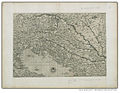
 Sebastian Münster - Descriptio totius Illyridis.jpg 1,535 × 1,200; 2.2 MB
-
 Print, book-illustration, map (BM 1982,U.2466).jpg 1,878 × 1,739; 1.08 MB
-
 Sclauonia oder Windisch Marck, Bossen, Crabaten 1548.jpg 2,442 × 1,938; 721 KB
-
 Geographiae Claudii Ptolemaei Alexandrini (Münster, 1552) 45.jpg 10,608 × 6,784; 6.73 MB
-
 Wolfgang Lazius - Ducatus Carniolae et Histriae una cum Marcha Windorum.png 2,513 × 1,845; 13.44 MB
-
 1593 map of the Danube by Cornelis de Jode.jpg 2,326 × 1,600; 1.2 MB
-
 Atlas Ortelius KB PPN369376781-060av-060br.jpg 3,000 × 2,194; 4.59 MB
-
 Atlas Ortelius KB PPN369376781-076av-076br.jpg 3,000 × 2,194; 4.75 MB
-
 Atlas Ortelius KB PPN369376781-077av-077br.jpg 3,000 × 2,194; 4.58 MB
-
 Austria archiducatus 1593.jpg 2,073 × 1,577; 586 KB
-
 Carinthiae ducatus et Goritiae palatinatus 1573.jpg 2,904 × 1,984; 1.73 MB
-
 Coppo istra.jpg 1,000 × 752; 287 KB
-
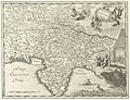
 Coppo italia.jpg 1,000 × 714; 261 KB
-
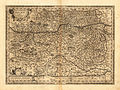
 Ducatus Carniolae una cum marcha Windorum 1569.jpg 2,543 × 1,920; 949 KB
-
 Ducatus Carniolae una cum Marcha Windorum 1569.jpg 2,514 × 1,902; 1.62 MB
-
 Ducatus Carniolae una cum Marchia Windorum.jpg 1,340 × 1,054; 415 KB
-
 Ducatus Carnioliae Tabula.jpg 1,500 × 1,147; 728 KB
-
 Folded woodcut map of Cerknisko Lake and environs.jpg 3,614 × 2,780; 8.32 MB
-
 Gastaldi - Geografia particolare.jpg 1,354 × 1,054; 885 KB
-
 Goritiae, Karstii, Chaczeolae, Carniolae, Histriae et Windorum Marchae descrip 1584.jpg 3,324 × 4,476; 3.67 MB
-
 Goritiae, Karstii, Chaczeolae, Carniolae, Histriae, Et Windorvm Marchae Descrip.jpg 1,500 × 2,168; 1.14 MB
-

-
 Illyricum 1572 (alt).jpg 4,500 × 3,601; 11.52 MB
-
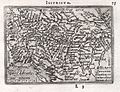
 Illyricum 1572.jpg 3,226 × 2,558; 1.2 MB
-
 Illyricum 1584.jpg 6,647 × 5,352; 8.19 MB
-
 Illyricum. Slavoniae, Croatiae, Carniae, Istriae, Bosniae descr. 1589.jpg 1,411 × 1,086; 690 KB
-
 Istrien 1892.jpg 3,595 × 2,583; 8.77 MB
-
 Lazius - Austriae descrip.jpg 2,263 × 1,700; 2.55 MB
-
 Map of Istria 1569.jpg 3,516 × 2,259; 3.27 MB
-
 Muenster - Kranjska z Istro, Gorisko, Furlanijo.jpg 1,608 × 1,493; 866 KB
-
 Muenster - Sclauonia oder Windich Land sampt Dalmatia.jpg 1,749 × 1,296; 659 KB
-
 Pannoniae, et Illyrici veteris tabvla 1590.jpg 6,496 × 5,163; 26.47 MB
-
 Pietro Coppo - Histriae tabula (1573).jpg 1,200 × 790; 1.2 MB
-

-

-

-

-

-
 Quinta Europa Tabula 1520 (alt).jpg 5,000 × 3,229; 5.16 MB
-
 Quinta Europa Tabula 1520.jpg 6,484 × 4,188; 2.7 MB
-

-
 Sclauonia oder Windisch Land sampt Dalmatia 1548.jpg 2,240 × 1,680; 755 KB
-
 Sclauonia oder Windisch Marck, Bossen, Crabaten 1550.jpg 2,324 × 2,095; 888 KB
-

-
 Sebastian Munster map Carniola.png 869 × 795; 1.71 MB
-
 Stiria 16th century.jpg 2,923 × 2,093; 870 KB
-
 Tirolensis et Carniola Comitatus 1593.jpg 13,047 × 9,418; 17.59 MB


.jpg)

_45.jpg)


.jpg)


.jpg)


.jpg)


