Category:16th-century maps of Croatia
Jump to navigation
Jump to search
Countries of Europe: Albania · Armenia‡ · Austria · Azerbaijan‡ · Belarus · Belgium · Bosnia and Herzegovina · Bulgaria · Croatia · Cyprus‡ · Czech Republic · Denmark · Estonia · Finland · France‡ · Georgia‡ · Germany · Greece · Hungary · Iceland · Republic of Ireland · Italy · Latvia · Lithuania · Luxembourg · Moldova · Netherlands‡ · Norway · Poland · Portugal‡ · Romania · Russia‡ · Serbia · Slovakia · Slovenia · Spain‡ · Sweden · Switzerland · Turkey‡ · Ukraine
Specific status: Isle of Man – Limited recognition: Abkhazia‡
‡: partly located in Europe
Specific status: Isle of Man – Limited recognition: Abkhazia‡
‡: partly located in Europe
Subcategories
This category has the following 7 subcategories, out of 7 total.
- 1560s maps of Croatia (1 F)
- 1570s maps of Croatia (10 F)
- 1580s maps of Croatia (2 F)
Media in category "16th-century maps of Croatia"
The following 11 files are in this category, out of 11 total.
-
 Sebastian Münster - Descriptio totius Illyridis.jpg 1,535 × 1,200; 2.2 MB
-
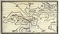
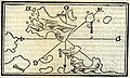
 Map of Hvar (Liezena) and - Bordone Benedetto - 1547.jpg 800 × 501; 213 KB
-
-

-

-
-
 Sclauonia oder Windisch Land sampt Dalmatia 1548.jpg 2,240 × 1,680; 755 KB
-
 Sclauonia oder Windisch Marck, Bossen, Crabaten 1548.jpg 2,442 × 1,938; 721 KB
-
 Illyricum 1584.jpg 6,647 × 5,352; 8.19 MB
-
 Katzianer's Campaign Map.svg 1,611 × 1,001; 271 KB
-
 KninPrikaz1500s.png 575 × 389; 463 KB

_and_-_Bordone_Benedetto_-_1547.jpg)

_and_Losinj_(Ossero)_islands,_also_charting_Istria,_and_Krk_(Vegia)_and_Rab_(Arbe)_islands_-_Bordone_Benedetto_-_1547.jpg)
,_Kres_(Cherso),_Rab_(Arbe)_and_Pag_(Pago)_islands,_and_of_the_Dalmatian_coast,_with_the_cities_of_Sen_-_Bordone_Benedetto_-_1547.jpg)
,_%C4%8Ciovo_(Bua)_island,_San_Andrea_(Svetac)_island,_and_part_o_-_Bordone_Benedetto_-_1547.jpg)


