Category:16th-century maps of Belgium
Jump to navigation
Jump to search
Countries of Europe: Albania · Armenia‡ · Austria · Azerbaijan‡ · Belarus · Belgium · Bosnia and Herzegovina · Bulgaria · Croatia · Cyprus‡ · Czech Republic · Denmark · Estonia · Finland · France‡ · Georgia‡ · Germany · Greece · Hungary · Iceland · Republic of Ireland · Italy · Latvia · Lithuania · Luxembourg · Moldova · Netherlands‡ · Norway · Poland · Portugal‡ · Romania · Russia‡ · Serbia · Slovakia · Slovenia · Spain‡ · Sweden · Switzerland · Turkey‡ · Ukraine
Specific status: Isle of Man – Limited recognition: Abkhazia‡
‡: partly located in Europe
Specific status: Isle of Man – Limited recognition: Abkhazia‡
‡: partly located in Europe
Subcategories
This category has the following 9 subcategories, out of 9 total.
- 1570s maps of Belgium (5 F)
- 1580s maps of Belgium (5 F)
- 1590s maps of Belgium (6 F)
M
Media in category "16th-century maps of Belgium"
The following 12 files are in this category, out of 12 total.
-

-
 Print, book-illustration, map (BM 1982,U.2433).jpg 1,799 × 1,380; 775 KB
-
 Print, book-illustration, map (BM 1982,U.2447).jpg 1,603 × 1,125; 550 KB
-
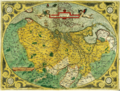
 Germania Teütschland - Geldern, Brabandt, Flandren.jpg 533 × 774; 91 KB
-
 UBBasel Map 1559 Kartenslg AA 65 Flandria.tiff 12,048 × 9,803, 2 pages; 337.93 MB
-
 UBBasel Map 1580 Kartenslg Mappe 234-2 Belgica.tiff 8,965 × 5,928, 2 pages; 305.9 MB
-
 Brussels map by Jacob van Deventer, Atlas des villes des Pays-Bas, 73 places levées, ca. 1555 (2) 01.png 8,908 × 10,941; 135.66 MB
-

-
 Brussels map by Jacob van Deventer, Atlas des villes des Pays-Bas, 73 places levées, ca. 1555.png 9,216 × 12,288; 132.34 MB
-
 Descriptio Germaniae inferioris Nederlanden 1573.png 1,778 × 1,352; 7.32 MB
-
 Descriptio Germaniae Inferioris Nederlanden Map by Abraham Ortelius 1573.jpg 6,817 × 5,153; 15.69 MB
-
 England and the Low Countries, old map by Christiaan Sgroten.jpg 1,546 × 670; 1.4 MB

.jpg)
.jpg)

_01.png)
_02.png)


