Category:16th-century maps of Belarus
Jump to navigation
Jump to search
Countries of Europe: Albania · Armenia‡ · Austria · Azerbaijan‡ · Belarus · Belgium · Bosnia and Herzegovina · Bulgaria · Croatia · Cyprus‡ · Czech Republic · Denmark · Estonia · Finland · France‡ · Georgia‡ · Germany · Greece · Hungary · Iceland · Republic of Ireland · Italy · Latvia · Lithuania · Luxembourg · Moldova · Netherlands‡ · Norway · Poland · Portugal‡ · Romania · Russia‡ · Serbia · Slovakia · Slovenia · Spain‡ · Sweden · Switzerland · Turkey‡ · Ukraine
Specific status: Isle of Man – Limited recognition: Abkhazia‡
‡: partly located in Europe
Specific status: Isle of Man – Limited recognition: Abkhazia‡
‡: partly located in Europe
Subcategories
This category has the following 2 subcategories, out of 2 total.
1
E
Media in category "16th-century maps of Belarus"
The following 6 files are in this category, out of 6 total.
-
 1539 Carta marina Olaus Magnus (Russia,Ukraine,Belarus,Moscovia).jpg 1,000 × 1,812; 870 KB
-
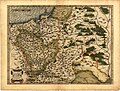 Ortelius Lithuania.jpg 2,220 × 1,682; 822 KB
-
 GDL-1586.jpg 1,562 × 1,288; 523 KB
-
 Maciej Strubycz, 1589, 'Magni Ducatus Lithuaniae, Livoniae et Moscoviae descriptio'.jpg 3,185 × 2,594; 3.99 MB
-
 Vialikaje Kniastva Litoŭskaje. Вялікае Княства Літоўскае (M. Strubicz, 1589).jpg 5,113 × 3,896; 25.76 MB
-
 SAPUNOV(1893) -04- p049.jpg 1,797 × 2,751; 2.45 MB
.jpg)


.jpg)
_-04-_p049.jpg)