Category:16th-century maps of Denmark
Jump to navigation
Jump to search
Countries of Europe: Albania · Armenia‡ · Austria · Azerbaijan‡ · Belarus · Belgium · Bosnia and Herzegovina · Bulgaria · Croatia · Cyprus‡ · Czech Republic · Denmark · Estonia · Finland · France‡ · Georgia‡ · Germany · Greece · Hungary · Iceland · Republic of Ireland · Italy · Latvia · Lithuania · Luxembourg · Moldova · Netherlands‡ · Norway · Poland · Portugal‡ · Romania · Russia‡ · Serbia · Slovakia · Slovenia · Spain‡ · Sweden · Switzerland · Turkey‡ · Ukraine
Specific status: Isle of Man – Limited recognition: Abkhazia‡
‡: partly located in Europe
Specific status: Isle of Man – Limited recognition: Abkhazia‡
‡: partly located in Europe
Subcategories
This category has the following 8 subcategories, out of 8 total.
#
.
1
C
M
Media in category "16th-century maps of Denmark"
The following 10 files are in this category, out of 10 total.
-
 Olaus Magnus Scandza.gif 1,600 × 2,483; 1.53 MB
-

-
 Print, book-illustration, map (BM 1982,U.2455).jpg 1,629 × 1,206; 555 KB
-
 Dk-kort-1554-dln2.jpg 476 × 352; 114 KB
-
 Denmark 1570.jpg 4,960 × 3,496; 5.99 MB
-
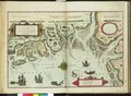
 Map of Denmark from the Atlas “Theatrum orbis terrarum” WDL11259.png 1,299 × 1,024; 2.76 MB
-
 Atlas Ortelius KB PPN369376781-039av-039br.jpg 3,000 × 2,194; 4.07 MB
-
 Theatrum orbis terrarum (1570) (14595026049).jpg 3,434 × 2,708; 3.04 MB
-
 Carta Marina Fyn.jpg 176 × 199; 11 KB
-

.jpg)
.jpg)


_(14595026049).jpg)
