Category:Topographic maps of Massachusetts
Jump to navigation
Jump to search
States of the United States: Alabama · Alaska · Arizona · Arkansas · California · Colorado · Connecticut · Delaware · Florida · Georgia · Hawaii · Idaho · Illinois · Indiana · Iowa · Kansas · Kentucky · Louisiana · Maine · Maryland · Massachusetts · Michigan · Minnesota · Mississippi · Missouri · Montana · Nebraska · Nevada · New Hampshire · New Jersey · New Mexico · New York · North Carolina · North Dakota · Ohio · Oklahoma · Oregon · Pennsylvania · Rhode Island · South Carolina · South Dakota · Tennessee · Texas · Utah · Vermont · Virginia · Washington · West Virginia · Wisconsin · Wyoming – Washington, D.C.
American Samoa · Puerto Rico · United States Virgin Islands
American Samoa · Puerto Rico · United States Virgin Islands
Subcategories
This category has only the following subcategory.
Media in category "Topographic maps of Massachusetts"
The following 19 files are in this category, out of 19 total.
-
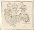
 1836 Provincetown US Topographical Bureau.jpg 5,760 × 4,800; 1.29 MB
-
 1884 topographical map of West Roxbury Park.jpg 10,224 × 7,214; 7.85 MB
-
 1889 USGS Provincetown.png 2,238 × 1,496; 5.61 MB
-
-
 1896 map of Beaver Brook Reservation (BHL40352840).jpg 6,396 × 2,892; 3.13 MB
-

-

-
 376 of 'Elementary Physical Geography' (11301329966).jpg 886 × 1,250; 337 KB
-
 Holyoke Range map-en.svg 1,360 × 372; 142 KB
-
 Hypsocontours.png 1,224 × 792; 1.12 MB
-
 HypsoTintedContours.pdf 2,550 × 1,650; 674 KB
-
 Mount Tom Range map-en.svg 462 × 616; 213 KB
-
 Pocksha Pond.jpg 876 × 669; 264 KB
-
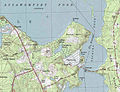
 Salem Beverly Waterway Canal - USGS map (1 July 1985).jpg 1,000 × 800; 294 KB
-
 Topographic map of Massachusetts and Rhode Island (8345527561).jpg 800 × 509; 82 KB
-
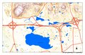
 Topographical map of Blue Hills Reservation (9471060059).jpg 800 × 478; 84 KB
-
 Topographical map of Middlesex Fells Reservation (2674376379).jpg 2,000 × 1,765; 2.71 MB
-

-
 Watson Pond-Snake River.jpg 719 × 772; 293 KB


.jpg)


.jpg)


.jpg)
.jpg)
.jpg)
.jpg)
.jpg)
