Category:Topographic maps of Wyoming
Jump to navigation
Jump to search
States of the United States: Alabama · Alaska · Arizona · Arkansas · California · Colorado · Connecticut · Delaware · Florida · Georgia · Hawaii · Idaho · Illinois · Indiana · Iowa · Kansas · Kentucky · Louisiana · Maine · Maryland · Massachusetts · Michigan · Minnesota · Mississippi · Missouri · Montana · Nebraska · Nevada · New Hampshire · New Jersey · New Mexico · New York · North Carolina · North Dakota · Ohio · Oklahoma · Oregon · Pennsylvania · Rhode Island · South Carolina · South Dakota · Tennessee · Texas · Utah · Vermont · Virginia · Washington · West Virginia · Wisconsin · Wyoming – Washington, D.C.
American Samoa · Puerto Rico · United States Virgin Islands
American Samoa · Puerto Rico · United States Virgin Islands
Subcategories
This category has the following 3 subcategories, out of 3 total.
Media in category "Topographic maps of Wyoming"
The following 23 files are in this category, out of 23 total.
-
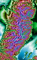
 Absaroka Mtn Range Wyoming Topo Rainbow Zebra 2346.png 4,247 × 6,191; 38.25 MB
-
 Bighorn Mountains Wyoming Topo Rainbow Zebra 2550.png 3,613 × 3,107; 8.52 MB
-
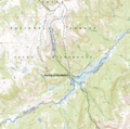
 Bozeman01.png 1,049 × 1,033; 1.76 MB
-
 Gallatin Range.JPG 629 × 335; 89 KB
-
 Grand Teton National Park Wyom Topo Rainbow Zebra 2142.png 4,025 × 6,526; 19.88 MB
-
 Missouri Buttes topo.jpg 952 × 578; 172 KB
-
 Topographical map of the Yellowstone National Park, Wyoming-Montana-Idaho. LOC 97683577.tif 9,136 × 10,832; 283.13 MB
-
 Two Ocean Pass USGS Topo.png 1,302 × 1,293; 3.7 MB
-
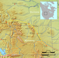
 USA Region West relief Gros Ventre Range location map.jpg 1,867 × 2,091; 1.05 MB
-
 USA Region West relief Pryor Mountains location map.jpg 1,867 × 2,091; 1.05 MB
-
 USA Region West relief Teton Range location map.jpg 1,867 × 2,091; 1.05 MB
-
 Wind River Mtn Range Wyoming Topo Rainbow Zebra 1326.png 4,898 × 3,891; 19.08 MB
-
 Wind River Mtn Range Wyoming Topo Rainbow Zebra 2142.png 4,898 × 3,891; 21.55 MB
-
 Wpdms nasa topo bridger mountains wyoming.jpg 335 × 280; 30 KB
-
 Wpdms nasa topo granite mountains.jpg 335 × 280; 30 KB
-
 Wpdms nasa topo owl creek mountains.jpg 335 × 280; 30 KB
-
 Wpdms nasa topo shoshone basin.jpg 335 × 280; 30 KB
-
 Wpdms southpass.jpg 300 × 271; 45 KB
-
 WY Laramie 342499 1895 125000.jpg 2,413 × 3,015; 1.56 MB
-
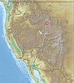
 Wyoming ref 2001.jpg 757 × 590; 263 KB
-
 Wyoming Relief 1.jpg 500 × 432; 90 KB
-
 Yellowstone Caldera NW Wyoming Topo Rainbow Zebra 2346.jpg 4,404 × 3,033; 10.93 MB
-
 Yellowstone.png 750 × 750; 242 KB


