Category:Topographic maps of Colorado
Jump to navigation
Jump to search
States of the United States: Alabama · Alaska · Arizona · Arkansas · California · Colorado · Connecticut · Delaware · Florida · Georgia · Hawaii · Idaho · Illinois · Indiana · Iowa · Kansas · Kentucky · Louisiana · Maine · Maryland · Massachusetts · Michigan · Minnesota · Mississippi · Missouri · Montana · Nebraska · Nevada · New Hampshire · New Jersey · New Mexico · New York · North Carolina · North Dakota · Ohio · Oklahoma · Oregon · Pennsylvania · Rhode Island · South Carolina · South Dakota · Tennessee · Texas · Utah · Vermont · Virginia · Washington · West Virginia · Wisconsin · Wyoming – Washington, D.C.
American Samoa · Puerto Rico · United States Virgin Islands
American Samoa · Puerto Rico · United States Virgin Islands
Subcategories
This category has the following 5 subcategories, out of 5 total.
Media in category "Topographic maps of Colorado"
The following 40 files are in this category, out of 40 total.
-
 Topographic map of Colorado, 1913 - DPLA - d75176df7e1e681e1df6298868f64ce6.jpg 11,479 × 8,300; 22.06 MB
-
 Bison Peak GPS Track.jpg 2,000 × 2,000; 1.27 MB
-
 San Juan National Forest - 90 topographic quad maps - southwest Colorado (IA CAT91951964).pdf 912 × 1,562, 100 pages; 32.81 MB
-
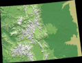
 Climax Colorado shaded-relief perspective 3.jpg 695 × 600; 103 KB
-
 Colorado geographic map-en.svg 2,581 × 2,200; 7.2 MB
-
 Colorado Rockies 36to42N 104to110W Topo Rainbow Zebra 1224.jpg 7,200 × 7,200; 41.6 MB
-
 Colorado.png 1,066 × 821; 426 KB
-

-

-

-
 Grays and Torreys GPS Track.jpg 2,000 × 2,000; 1.68 MB
-
 La Junta CO 1996.jpg 2,681 × 2,058; 1.51 MB
-
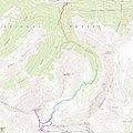
 Longs Peak gps track.jpg 2,000 × 920; 741 KB
-
 Missouri Mountain GPS Track.jpg 2,000 × 2,000; 1.61 MB
-
 Mt Huron and La Plata Peak GPS Track.jpg 2,000 × 2,000; 1.47 MB
-
 Mt Sherman GPS Track.jpg 2,000 × 2,000; 865 KB
-
 Mt. Antero GPS Track.jpg 2,000 × 2,000; 1.58 MB
-

-

-
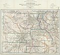
 Nell's topographical map of the State of Colorado - DPLA - 85d3ef6e49f097898024f51da220cd9c.jpg 8,999 × 7,035; 14.44 MB
-
 Nell's topographical map of the state of Colorado - DPLA - f7a7145f97d9f30a355c7a8c362f0a38.jpg 9,000 × 6,849; 14.47 MB
-
 NPS rocky-mountain-topo-map.jpg 8,013 × 4,818; 10.78 MB
-
 Parts of south western Colorado, atlas sheet 61A - DPLA - 456458d38118c6a18e317437e519392e.jpg 8,000 × 7,394; 12.77 MB
-
 Parts of Southwestern Colorado - DPLA - 8aa2d787b5f476f83dfbb906616b6f6c.jpg 7,500 × 5,957; 4.63 MB
-

-

-

-
 Rocky Mountain National Park CO Topo Rainbow Zebra 2142.png 4,715 × 5,795; 36.28 MB
-
 San Juan Mtns in SW Colorado Topo Rainbow Zebra 1326.png 6,281 × 3,776; 31.75 MB
-
 Sawatch and Elk Mtns Colorado Topo Rainbow Zebra 1734.png 5,140 × 5,367; 37.43 MB
-
 South Boulder Peak and Bear Peak GPS Track.jpg 2,000 × 1,388; 858 KB
-
 Topographic map of Silver Lake Basin.tif 3,011 × 2,262; 19.52 MB
-
-

-

-
 USA Colorado relief location map.svg 1,067 × 783; 2.18 MB
-
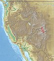
 USA Region West relief Elk (Colorado) location map.jpg 1,867 × 2,091; 1.02 MB
-
 USA Region West relief Grand Mesa location map.jpg 1,867 × 2,091; 1.05 MB
-
 USA Region West relief Sangre de Cristo Range location map.jpg 1,867 × 2,091; 1.05 MB
-
 USA Region West relief Sawatch Range location map.jpg 1,867 × 2,091; 1.05 MB


_location_map.jpg)


