Category:Topographic maps of Texas
Appearance
States of the United States: Alabama · Alaska · Arizona · Arkansas · California · Colorado · Connecticut · Delaware · Florida · Georgia · Hawaii · Idaho · Illinois · Indiana · Iowa · Kansas · Kentucky · Louisiana · Maine · Maryland · Massachusetts · Michigan · Minnesota · Mississippi · Missouri · Montana · Nebraska · Nevada · New Hampshire · New Jersey · New Mexico · New York · North Carolina · North Dakota · Ohio · Oklahoma · Oregon · Pennsylvania · Rhode Island · South Carolina · South Dakota · Tennessee · Texas · Utah · Vermont · Virginia · Washington · West Virginia · Wisconsin · Wyoming – Washington, D.C.
American Samoa · Puerto Rico · United States Virgin Islands
American Samoa · Puerto Rico · United States Virgin Islands
Subcategories
This category has the following 2 subcategories, out of 2 total.
Media in category "Topographic maps of Texas"
The following 35 files are in this category, out of 35 total.
-
ClemensUnitTopog.PNG 555 × 568; 489 KB
-
CoffieldUnitTopographical.PNG 891 × 638; 1.04 MB
-
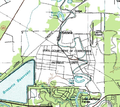
Crafton TX.png 711 × 467; 386 KB
-
DarringtonUnitTopographical.PNG 764 × 384; 426 KB
-
EasthamFergusonUnits.PNG 990 × 668; 1.02 MB
-
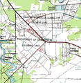
EllisEstelleUnits.PNG 640 × 682; 889 KB
-
GatesvilleStateSchoolTopographical.PNG 420 × 445; 389 KB
-
Glenrio-topographic-map.png 1,013 × 805; 732 KB
-
GoreeUnitNewTopo.PNG 839 × 412; 746 KB
-
GoreeUnitTopog.PNG 528 × 308; 341 KB
-
Hicks Airfield Map.jpg 506 × 392; 27 KB
-
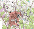
HuntsvilleCityMap.PNG 1,193 × 1,023; 2.78 MB
-
JesterHarlemPrisonFarmFortBendCoTx.png 792 × 710; 994 KB
-
Lake Cypress Springs Topographical Map.png 2,048 × 1,223; 1.03 MB
-
MapaTopográficoDeTexasGeografíaFísica.svg 2,164 × 2,000; 7.39 MB
-
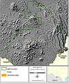
Marathon Uplift-Ouachita Orogen shaded relief.jpg 845 × 851; 265 KB
-
NPS big-bend-topography-map.jpg 1,012 × 1,209; 368 KB
-
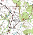
Pecan Gap crop 1.png 980 × 560; 659 KB
-
Pecan Gap Quadrangle 1964.jpg 700 × 859; 178 KB
-
Pilares Texas Topo Map.jpg 1,275 × 891; 485 KB
-
RamseyUnitsBrazTX.png 908 × 546; 631 KB
-
Relief map of Texas.png 1,000 × 989; 1.28 MB
-
RetrieveUnitBrazoriaAirport.PNG 628 × 562; 506 KB
-
Saginaw Airport Map.jpg 356 × 307; 14 KB
-
San Vicente Texas Topo Map.jpg 1,300 × 1,148; 382 KB
-
Smeltertown 121446 1955 24000 1975.png 2,000 × 2,428; 5.69 MB
-
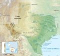
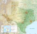
Texas topographic map-en.svg 2,164 × 2,000; 13.78 MB
-
Texas topographic map-es.svg 2,164 × 2,000; 14.83 MB
-
Texas topographic.jpg 840 × 691; 227 KB
-
USA Region West relief Chisos Mountains location map.jpg 1,867 × 2,091; 1.05 MB
-
USA Region West relief Guadalupe Mountains location map.jpg 1,867 × 2,091; 1.05 MB
-
USA Region West relief location map Davis Mountains.jpg 1,867 × 2,091; 1.02 MB
-
WynneUnitTopog.PNG 443 × 198; 180 KB
-
WynneUnitTopoMapNew.PNG 1,301 × 885; 2.11 MB

