Category:SVG maps of Jammu and Kashmir (state)
Jump to navigation
Jump to search
States of India: Andhra Pradesh · Arunachal Pradesh · Assam · Bihar · Chhattisgarh · Goa · Gujarat · Haryana · Himachal Pradesh · Jharkhand · Karnataka · Kerala · Madhya Pradesh · Maharashtra · Manipur · Meghalaya · Mizoram · Nagaland · Odisha · Punjab · Rajasthan · Sikkim · Tamil Nadu · Telangana · Tripura · Uttar Pradesh · Uttarakhand · West Bengal
Union territories: Andaman and Nicobar Islands · Chandigarh · Dadra and Nagar Haveli and Daman and Diu · Delhi · Jammu and Kashmir · Ladakh · Lakshadweep · Puducherry
Former states of India: Jammu and Kashmir ·
Former union territories:
Union territories: Andaman and Nicobar Islands · Chandigarh · Dadra and Nagar Haveli and Daman and Diu · Delhi · Jammu and Kashmir · Ladakh · Lakshadweep · Puducherry
Former states of India: Jammu and Kashmir ·
Former union territories:
Media in category "SVG maps of Jammu and Kashmir (state)"
The following 12 files are in this category, out of 12 total.
-
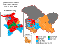 2019 Jammu and Kashmir Lok Sabha Elections Assembly Wise Leads Map.svg 1,048 × 817; 725 KB
-
 Flag-map of Jammu and Kashmir.svg 992 × 657; 28 KB
-
 India J&K state locator map.svg 1,574 × 1,738; 966 KB
-
 India Jammu and Kashmir state adm location map.svg 1,722 × 1,301; 234 KB
-
 India Jammu and Kashmir state location map.svg 1,722 × 1,301; 191 KB
-
 India Jammu and Kashmir state location map2.svg 1,722 × 1,301; 998 KB
-
 India-JAMMUANDKASHMIR.svg 1,486 × 1,734; 426 KB
-
 Jammu & Kashmir Distrikte.svg 1,090 × 652; 153 KB
-
 Jammu & Kashmir Wahlkreise Lok Sabha (2014).svg 648 × 505; 562 KB
-
 Religion in Jammu and Kashmir (state).svg 2,667 × 2,093; 369 KB
-
 جموں و کشمیر کے اضلاع.svg 1,090 × 652; 153 KB
-
 জম্মু ও কাশ্মীর রাজ্যের লোকসভা কেন্দ্র.svg 648 × 505; 562 KB


.svg)
.svg)

