Category:Maps of Jammu and Kashmir (state)
Jump to navigation
Jump to search
States of India: Andhra Pradesh · Arunachal Pradesh · Assam · Bihar · Chhattisgarh · Goa · Gujarat · Haryana · Himachal Pradesh · Jharkhand · Karnataka · Kerala · Madhya Pradesh · Maharashtra · Manipur · Meghalaya · Mizoram · Nagaland · Odisha · Punjab · Rajasthan · Sikkim · Tamil Nadu · Telangana · Tripura · Uttar Pradesh · Uttarakhand · West Bengal
Union territories: Andaman and Nicobar Islands · Chandigarh · Dadra and Nagar Haveli and Daman and Diu · Delhi · Jammu and Kashmir · Ladakh · Lakshadweep · Puducherry
Former states of India: Jammu and Kashmir ·
Former union territories: Dadra and Nagar Haveli district · Daman and Diu ·
Union territories: Andaman and Nicobar Islands · Chandigarh · Dadra and Nagar Haveli and Daman and Diu · Delhi · Jammu and Kashmir · Ladakh · Lakshadweep · Puducherry
Former states of India: Jammu and Kashmir ·
Former union territories: Dadra and Nagar Haveli district · Daman and Diu ·
Wikimedia category | |||||
| Upload media | |||||
| Instance of | |||||
|---|---|---|---|---|---|
| Category combines topics | |||||
| Jammu and Kashmir | |||||
former state administered by India  someja satełitar in otobre    | |||||
| Instance of | |||||
| Location |
| ||||
| Capital | |||||
| Legislative body |
| ||||
| Official language | |||||
| Head of state |
| ||||
| Head of government |
| ||||
| Inception |
| ||||
| Dissolved, abolished or demolished date |
| ||||
| Population |
| ||||
| Area |
| ||||
| Elevation above sea level |
| ||||
| Follows | |||||
| Followed by | |||||
| Different from | |||||
| official website | |||||
 | |||||
Subcategories
This category has the following 6 subcategories, out of 6 total.
P
S
Media in category "Maps of Jammu and Kashmir (state)"
The following 8 files are in this category, out of 8 total.
-
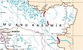
 Jammu and Kashmir in 1954 Political Map of India.jpg 1,014 × 700; 176 KB
-
 Jammu and Kashmir in 1959 Political Map of India.jpg 2,137 × 1,515; 937 KB
-
 Jammu et cachemire population.png 2,000 × 1,570; 210 KB
-
 Jk bifurcation.jpg 1,099 × 830; 71 KB
-
 Map of J&K Highlighting JKP Jurisdiction.png 794 × 600; 144 KB
-
 Survey of India Road Map Cropped.jpg 1,008 × 611; 106 KB
-
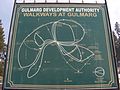 Walkways-at-Gulmarg.JPG 2,560 × 1,920; 1.9 MB
-
 જમ્મુ કાશ્મીર કેન્દ્રશાસિત પ્રદેશ.jpg 648 × 473; 24 KB


