Category:SVG maps of Telangana
Jump to navigation
Jump to search
States of India: Andhra Pradesh · Arunachal Pradesh · Assam · Bihar · Chhattisgarh · Goa · Gujarat · Haryana · Himachal Pradesh · Jharkhand · Karnataka · Kerala · Madhya Pradesh · Maharashtra · Manipur · Meghalaya · Mizoram · Nagaland · Odisha · Punjab · Rajasthan · Sikkim · Tamil Nadu · Telangana · Tripura · Uttar Pradesh · Uttarakhand · West Bengal
Union territories: Andaman and Nicobar Islands · Chandigarh · Dadra and Nagar Haveli and Daman and Diu · Delhi · Jammu and Kashmir · Ladakh · Lakshadweep · Puducherry
Former states of India: Jammu and Kashmir ·
Former union territories:
Union territories: Andaman and Nicobar Islands · Chandigarh · Dadra and Nagar Haveli and Daman and Diu · Delhi · Jammu and Kashmir · Ladakh · Lakshadweep · Puducherry
Former states of India: Jammu and Kashmir ·
Former union territories:
Subcategories
This category has the following 2 subcategories, out of 2 total.
!
Media in category "SVG maps of Telangana"
The following 26 files are in this category, out of 26 total.
-
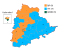
2024 Lok Sabha Telangana Result Map.svg 744 × 638; 887 KB
-
2024 Telangana Lok Sabha Elections Assembly Wise Map.svg 862 × 739; 235 KB
-
Andhra Pradesh districts 2014.svg 748 × 708; 311 KB
-
Andhra Pradesh Landesteile.svg 685 × 639; 37 KB
-
Flag of Bharat Rashtra Samithi (India Nation Council).svg 860 × 640; 6 KB
-
Hussain Sagar Map.svg 1,868 × 1,880; 1.75 MB
-
Hyderabad India map attempt 1.svg 890 × 898; 3.44 MB
-
India Telangana location map.svg 851 × 852; 367 KB
-
India Telangana locator map.svg 1,639 × 1,852; 795 KB
-
India Telangana numbered district map 2022.svg 681 × 681; 233 KB
-
Location map India Telangana (blank).svg 1,070 × 740; 424 KB
-
Map of Telangana at the time of formation on June 02 2014.svg 512 × 497; 129 KB
-
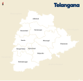
Telangana districts.svg 512 × 497; 5.05 MB
-
Telangana in India.svg 1,500 × 1,615; 1.56 MB
-
Telangana locator map.svg 537 × 508; 1.82 MB
-
Telangana map for WLM-IN.svg 797 × 808; 40 KB
-
Telangana Rebellion District-ta.svg 601 × 601; 120 KB
-
Telangana State English Map.svg 637 × 602; 1.84 MB
-
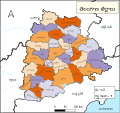
Telangana State Telugu Map.svg 637 × 602; 1.85 MB
-
Telangana Wahlkreise Lok Sabha (2) 2014.svg 700 × 638; 756 KB
-
Telangana Wahlkreise Lok Sabha.svg 744 × 638; 884 KB
-
Telengana state outline.svg 800 × 718; 54 KB
-
TG-districts-te.svg 667 × 630; 2.7 MB
-
Vijayanagara-empire-map.svg 1,585 × 1,850; 372 KB
-
Wahlkreise zur Vidhan Sabha von Telangana.svg 862 × 739; 231 KB
-
তেলেঙ্গানার লোকসভা কেন্দ্র.svg 744 × 638; 883 KB


