Category:SVG maps of Tamil Nadu
Jump to navigation
Jump to search
States of India: Andhra Pradesh · Arunachal Pradesh · Assam · Bihar · Chhattisgarh · Goa · Gujarat · Haryana · Himachal Pradesh · Jharkhand · Karnataka · Kerala · Madhya Pradesh · Maharashtra · Manipur · Meghalaya · Mizoram · Nagaland · Odisha · Punjab · Rajasthan · Sikkim · Tamil Nadu · Telangana · Tripura · Uttar Pradesh · Uttarakhand · West Bengal
Union territories: Andaman and Nicobar Islands · Chandigarh · Dadra and Nagar Haveli and Daman and Diu · Delhi · Jammu and Kashmir · Ladakh · Lakshadweep · Puducherry
Former states of India: Jammu and Kashmir ·
Former union territories:
Union territories: Andaman and Nicobar Islands · Chandigarh · Dadra and Nagar Haveli and Daman and Diu · Delhi · Jammu and Kashmir · Ladakh · Lakshadweep · Puducherry
Former states of India: Jammu and Kashmir ·
Former union territories:
Subcategories
This category has only the following subcategory.
Media in category "SVG maps of Tamil Nadu"
The following 31 files are in this category, out of 31 total.
-
2024 NDA Alliance Lok Sabha Seat Sharing Tamil Nadu.svg 693 × 734; 2.92 MB
-
Ambuliyar River watershed.svg 691 × 517; 547 KB
-
Bijapur-sultanate-map.svg 1,651 × 1,753; 432 KB
-
India Tamil Nadu districts numbered.svg 1,591 × 1,975; 383 KB
-
India Tamil Nadu location map.svg 1,591 × 1,975; 840 KB
-
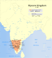
Indian Mysore Kingdom 1784 map-es.svg 1,639 × 1,852; 2.44 MB
-
Indian Mysore Kingdom 1784 map.svg 1,639 × 1,852; 476 KB
-
Kerala and Tamil Nadu - combined district map.svg 553 × 368; 353 KB
-
Madras 1951 Vanniyar.svg 756 × 716; 211 KB
-
Map of Tamil Nadu districts.svg 1,668 × 2,032; 209 KB
-
SVG Map River Vaigai EN.svg 567 × 709; 343 KB
-
Tamil Nadu district map (Tamil).svg 1,640 × 2,032; 297 KB
-
Tamil Nadu district map as.svg 1,640 × 2,032; 89 KB
-
Tamil Nadu district map-gu.svg 1,640 × 2,032; 144 KB
-
Tamil Nadu district map-kn.svg 1,640 × 2,032; 151 KB
-
Tamil Nadu district map-ml.svg 1,640 × 2,032; 153 KB
-
Tamil Nadu district map-mr.svg 1,640 × 2,032; 105 KB
-
Tamil Nadu district map-pa.svg 1,640 × 2,032; 91 KB
-
Tamil Nadu district map-te.svg 1,640 × 2,032; 80 KB
-
Tamil Nadu district map.svg 1,640 × 2,032; 89 KB
-
Tamil Nadu districts map.svg 512 × 636; 373 KB
-
Tamil Nadu locator map-2010-29-10.svg 1,598 × 1,979; 412 KB
-
Tamil Nadu locator map.svg 1,591 × 1,975; 222 KB
-
Tamil Nadu map for WLM-IN.svg 1,411 × 1,880; 81 KB
-
Tamil Nadu outline map.svg 1,510 × 1,975; 38 KB
-
Tamil Nadu Wahlkreise Lok Sabha.svg 693 × 734; 2.06 MB
-
Tamil speakers map.svg 1,639 × 1,852; 260 KB
-
TN Map Divison Wise.svg 512 × 636; 373 KB
-
Vellar River basin map.svg 1,614 × 795; 882 KB
-
Wahlkreise zur Vidhan Sabha von Tamil Nadu.svg 1,262 × 1,206; 5.64 MB
-
তামিলনাড়ুর লোকসভা কেন্দ্র.svg 693 × 734; 2.06 MB


