Category:SVG maps of Gujarat
Jump to navigation
Jump to search
States of India: Andhra Pradesh · Arunachal Pradesh · Assam · Bihar · Chhattisgarh · Goa · Gujarat · Haryana · Himachal Pradesh · Jharkhand · Karnataka · Kerala · Madhya Pradesh · Maharashtra · Manipur · Meghalaya · Mizoram · Nagaland · Odisha · Punjab · Rajasthan · Sikkim · Tamil Nadu · Telangana · Tripura · Uttar Pradesh · Uttarakhand · West Bengal
Union territories: Andaman and Nicobar Islands · Chandigarh · Dadra and Nagar Haveli and Daman and Diu · Delhi · Jammu and Kashmir · Ladakh · Lakshadweep · Puducherry
Former states of India: Jammu and Kashmir ·
Former union territories:
Union territories: Andaman and Nicobar Islands · Chandigarh · Dadra and Nagar Haveli and Daman and Diu · Delhi · Jammu and Kashmir · Ladakh · Lakshadweep · Puducherry
Former states of India: Jammu and Kashmir ·
Former union territories:
Subcategories
This category has only the following subcategory.
!
Media in category "SVG maps of Gujarat"
The following 52 files are in this category, out of 52 total.
-
 2012 Gujarat Legislative Assembly Election Results Map.svg 1,420 × 1,080; 6.62 MB
-
 2017 Gujarat Legislative Assembly Election Results Map.svg 1,420 × 1,080; 6.62 MB
-
 2022 Gujarat Legislative Assembly Election Results Map.svg 1,420 × 1,080; 6.64 MB
-
 2024 Gujarat Lok Sabha Elections Assembly Wise Leads Map.svg 1,420 × 1,080; 6.54 MB
-
 2024 Lok Sabha Gujarat Result Map.svg 692 × 517; 2.38 MB
-
 Badami-chalukya-empire-map.svg 1,510 × 1,753; 339 KB
-
 Bombay 1956-1960 de.svg 893 × 765; 218 KB
-
 Gujarat in India (claimed and disputed hatched).svg 1,500 × 1,615; 1.64 MB
-
 Gujarat in India (claims hatched).svg 1,500 × 1,615; 2.4 MB
-
 Gujarat in India (disputed hatched).svg 1,500 × 1,615; 2.4 MB
-
 Gujarat in India.svg 1,500 × 1,615; 2.4 MB
-
 Gujarat locator map.svg 2,145 × 1,789; 247 KB
-
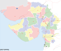
 Gujarat map for WLM-IN.svg 1,112 × 878; 122 KB
-
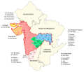
 Gujarat map with Gir Nat Park-de.svg 1,100 × 900; 438 KB
-
 Gujarat map with Gir Nat Park-fr.svg 1,180 × 940; 577 KB
-
 Gujarat map with Gir National Park-ca.svg 1,180 × 940; 568 KB
-
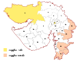 Gujarat Wahlkreise Lok Sabha gu.svg 692 × 517; 2.36 MB
-
 Gujarat Wahlkreise Lok Sabha.svg 692 × 517; 2.39 MB
-
 Gujarat-stub.svg 116 × 101; 6 KB
-
 India Gujarat location map (until 2013-08-15).svg 2,170 × 1,722; 362 KB
-
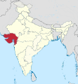
 India Gujarat location map.svg 1,173 × 931; 651 KB
-
 India Gujarat physical.svg 1,048 × 858; 456 KB
-
 Wahlkreise zur Vidhan Sabha von Gujarat gu.svg 1,420 × 1,080; 6.66 MB
-
 Wahlkreise zur Vidhan Sabha von Gujarat.svg 1,420 × 1,080; 6.66 MB
-
 Western-chalukya-empire-map.svg 1,510 × 1,753; 426 KB
-
 গুজরাতের লোকসভা কেন্দ্র.svg 692 × 517; 2.39 MB
-
 અમદાવાદ પશ્ચિમ – Ahmedabad West.svg 638 × 516; 1.12 MB
-
 અમદાવાદ પૂર્વ – Ahmedabad East.svg 638 × 516; 1.12 MB
-
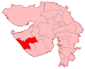
 અમરેલી – Amreli.svg 638 × 516; 1.12 MB
-
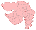
 આણંદ – Anand.svg 638 × 516; 1.12 MB
-
 કચ્છ – Kachchh.svg 638 × 516; 1.12 MB
-
 ખેડા – Kheda.svg 638 × 516; 1.12 MB
-
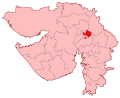
 ગાંધીનગર – Gandhinagar.svg 638 × 516; 1.12 MB
-
 છોટા ઉદેપુર – Chhota Udaipur.svg 638 × 516; 1.12 MB
-
 જામનગર – Jamnagar.svg 638 × 516; 1.12 MB
-
 જુનાગઢ – Junagadh.svg 638 × 516; 1.12 MB
-
 દાહોદ – Dahod.svg 638 × 516; 1.12 MB
-
 નવસારી – Navsari.svg 638 × 516; 1.12 MB
-
 પંચમહાલ – Panchmahal.svg 638 × 516; 1.12 MB
-
 પાટણ – Patan.svg 638 × 516; 1.12 MB
-
 પોરબંદર – Porbandar.svg 638 × 516; 1.12 MB
-
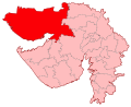
 બનાસકાંઠા – Banaskantha.svg 638 × 516; 1.12 MB
-
 બારડોલી – Bardoli.svg 638 × 516; 1.12 MB
-
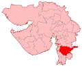
 ભરૂચ – Bharuch.svg 638 × 516; 1.12 MB
-
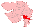
 ભાવનગર – Bhavnagar.svg 638 × 516; 1.12 MB
-
 મહેસાણા – Mahesana.svg 638 × 516; 1.12 MB
-
 રાજકોટ – Rajkot.svg 638 × 516; 1.12 MB
-
 વડોદરા – Vadodara.svg 638 × 516; 1.12 MB
-
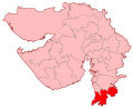 વલસાડ – Valsad.svg 638 × 516; 1.12 MB
-
 સાબરકાંઠા – Sabarkantha.svg 638 × 516; 1.12 MB
-
 સુરત – Surat.svg 638 × 516; 1.12 MB
-
 સુરેન્દ્રનગર – Surendranagar.svg 638 × 516; 1.12 MB


.svg)
.svg)
.svg)


.svg)


