Category:Rail transport maps of Saxony
Jump to navigation
Jump to search
Federal states of Germany:
Subcategories
This category has the following 4 subcategories, out of 4 total.
D
- Rail transport maps of Dresden (18 F)
L
Media in category "Rail transport maps of Saxony"
The following 143 files are in this category, out of 143 total.
-
 AbellioThueringen-Liniennetz 2016.png 1,223 × 630; 110 KB
-
 ABRM Gesamtnetz MD.png 2,339 × 3,307; 329 KB
-
 Album der Chemnitz-Annaberger Staats-Eisenbahn Seite 7 (1866).jpg 3,141 × 5,350; 2.88 MB
-
 Anschlussbahn Doberschütz Röcknitz Karte.jpg 2,286 × 2,051; 973 KB
-
 Bahnkarte Berlin Dresden.svg 205 × 514; 13.23 MB
-
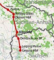
 Bahnstrecke Berlin–Dresden (Karte).jpg 2,242 × 2,463; 5.13 MB
-
 Bahnstrecke Berlin–Görlitz Karte.png 1,846 × 2,680; 5.96 MB
-
 Bahnstrecke Großenhain–Cottbus Karte.png 2,347 × 2,342; 4.38 MB
-
 Bahnstrecke Görlitz–Krzewina Zgorzelecka Karte.jpg 1,384 × 1,035; 825 KB
-
 Bahnstrecke Görlitz–Seidenberg Karte.jpg 1,384 × 1,035; 860 KB
-
 Bahnstrecke Halle–Cottbus (Karte).jpg 2,427 × 614; 1.41 MB
-
 Bahnstrecke Jüterbog–Röderau (Karte).jpg 1,125 × 1,263; 1.3 MB
-
 Bahnstrecke Knappenrode–Sornoer Buden.svg 1,447 × 1,001; 4.27 MB
-
 Bahnstrecke Leipzig–Großkorbetha (Karte).jpg 2,920 × 1,383; 2.36 MB
-
 Bahnstrecke Magdeburg–Leipzig Karte.svg 807 × 1,088; 28.73 MB
-
 Bahnstrecke Mockrehna-Schildau Karte.jpg 2,036 × 1,533; 751 KB
-
 Bahnstrecke Olbernhau-Grünthal–Deutschneudorf.png 2,315 × 1,713; 2.35 MB
-
 Bahnstrecke Trebnitz–Leipzig (Karte).jpg 1,208 × 1,341; 1.39 MB
-
 Bahnstrecke Węgliniec–Falkenberg (Karte).jpg 2,076 × 641; 1.34 MB
-
 Bahnstrecke-Niederwürschnitz-Stollberg-Planungsstand-2016-mit-Stationen.png 2,185 × 1,811; 2.93 MB
-
 Bahnstrecke-Niederwürschnitz-Stollberg-Planungsstand-2016.png 2,185 × 1,811; 2.92 MB
-
 Bautzen-Bad Schandau Streckenskizze 1902 (01).jpg 643 × 484; 86 KB
-
 Berlin - Görlitz Karte.png 800 × 950; 1.12 MB
-
 Bhn-Magdeburg-Leipzig.png 327 × 270; 38 KB
-
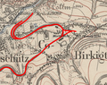 Birkigt.PNG 850 × 670; 1.07 MB
-
 Bogendreieck Werdau.png 1,010 × 664; 926 KB
-
 Brescius Graphik Windbergbahn.jpg 800 × 550; 190 KB
-
 CAAE-MAP.png 514 × 545; 694 KB
-
 CB Chemnitz.png 1,696 × 1,152; 216 KB
-
 Chemnitz-Komotauer Eisenbahn.png 382 × 410; 360 KB
-
 Chemnitz-Riesaer Eisenbahn.png 443 × 561; 518 KB
-
 Chemnitz-Wuerschnitzer Eisenbahn.png 421 × 338; 320 KB
-
 Chemnitztalbahn.jpg 424 × 429; 81 KB
-
 City-Bahn Chemnitz 2022.svg 899 × 975; 357 KB
-
 Connex-Sachsen-Netz-2008.png 3,080 × 2,184; 441 KB
-
 Deubener Kohlebahn.png 938 × 1,032; 1.78 MB
-
 Dresden–Děčín Streckenskizze 1902 (01).png 696 × 603; 323 KB
-
 Dürrröhrsdorf–Weißig Streckenskizze 1902 (01).png 456 × 323; 130 KB
-
 Eisenbahn Karte Wien–Dresden Ollmütz–Trübau 18.jpg 7,356 × 5,213; 19.08 MB
-
 Eisenbahnknoten Chemnitz 1902.png 411 × 308; 149 KB
-
 EisenbahnSachsen1840.png 1,850 × 1,260; 141 KB
-
 EisenbahnSachsen1860.png 1,850 × 1,260; 160 KB
-
 EisenbahnSachsen1880.png 1,850 × 1,260; 190 KB
-
 EisenbahnSachsen1900.png 1,850 × 1,260; 206 KB
-
 EisenbahnSachsen1920.png 1,850 × 1,260; 211 KB
-
 EisenbahnSachsennach1920.png 1,850 × 1,260; 206 KB
-
 Elstertalbahn.png 734 × 806; 708 KB
-
 Eisenbahnkarte Sachsen.gif 750 × 512; 224 KB
-
 FEG-Sachsen-2008.png 1,179 × 742; 46 KB
-
 FEG-Sachsen-2018.png 1,179 × 742; 58 KB
-
 Feldbahn im Saechsischen Eisenbahnmuseum.png 1,280 × 528; 181 KB
-
 Floehatalbahn.png 645 × 744; 234 KB
-
 FM Streckenskizze 1902 (01).png 493 × 274; 95 KB
-
 Franken-Sachsen-Express-Route.PNG 926 × 268; 39 KB
-
 Friedrich List und die erste grosse Eisenbahn 2.jpg 1,683 × 2,064; 422 KB
-
 Gittersee.PNG 1,484 × 807; 2.7 MB
-
 Gottleubatalbahn Streckenskizze 1902 (01-1).jpg 283 × 260; 22 KB
-
 HOe Streckenskizze 1902 (01).png 464 × 374; 145 KB
-
 Roell-1912 Karte der Sächsischen Eisenbahnen.jpg 3,314 × 2,295; 1.81 MB
-
 Streckennetz Sachsen 1902.png 3,340 × 2,120; 2.28 MB
-
 Karte Albertsbahn.jpg 2,430 × 2,123; 1.31 MB
-
 Karte Bahnstrecke Berlin—Dresden.png 1,708 × 4,281; 2.27 MB
-
 Karte der Bahnstrecke Leipzig-Eilenburg.png 1,500 × 1,218; 1.03 MB
-
 Karte der Bahnstrecke Lutherstadt Wittenberg–Torgau Eilenburg.png 1,654 × 2,322; 1.59 MB
-
 Karte der Bahnstrecke Wurzen-Eilenburg.png 2,176 × 2,155; 1.24 MB
-
 Karte der NBS Erfurt–Leipzig-Halle.png 2,175 × 1,397; 1.64 MB
-
 Karte der Windbergbahn.png 1,505 × 2,040; 1.26 MB
-
 Karte Kohlebahn Meuselwitz–Haselbach–Regis-Breitingen.png 2,218 × 1,324; 1.26 MB
-
 Karte Verkehrsprojekt Deutsche Einheit Nr. 8.png 748 × 1,011; 1.35 MB
-
 Klingenberg-Frauenstein Streckenskizze 1902 (01).png 439 × 348; 120 KB
-
 Kohlebahn Bannewitz.PNG 1,794 × 1,074; 4.55 MB
-
 Lage Bahnhof Goerlitz.PNG 2,039 × 1,066; 825 KB
-
 Lange diercke sachsen freistaat sachsen eisenbahnen.jpg 1,234 × 1,600; 1.08 MB
-
 Leipzig-Dresdner Eisenbahn.png 1,001 × 766; 1.59 MB
-
 Leipzig-Gera-Saalfeld.png 633 × 442; 133 KB
-
 Leipzig-Plagwitz–Gaschwitz.png 310 × 436; 188 KB
-
 Loessnitzgrundbahn.png 264 × 229; 132 KB
-
 Lubsko - Bad Muskau Karte.png 800 × 450; 420 KB
-
 Lübbenau - Kamenz Karte.png 800 × 520; 633 KB
-
 Map Fichtelbergbahn.png 347 × 222; 115 KB
-
 Map Fichtelbergbahn03.png 312 × 280; 83 KB
-
 Map ZittauerBahn.png 277 × 193; 87 KB
-
 Map-of-295-and-6207-Węgliniec-Roßlau.png 1,279 × 880; 2.09 MB
-
 Map-of-6207-State-border-Roßlau.png 1,279 × 880; 1.12 MB
-
 Map-of-6212-Görlitz-Dresden.png 1,301 × 663; 1.35 MB
-
 Map-of-6252-Großenhain-Priestewitz.png 1,255 × 867; 393 KB
-
 Map-of-6255-Riesa-Chemnitz.png 917 × 665; 1,023 KB
-
 Map-of-6265-Glauchau-Gößnitz.png 1,115 × 851; 472 KB
-
 Map-of-6274-Weißig-Böhla.png 1,387 × 873; 364 KB
-
 Map-of-6366-Leipzig-Geithain.png 1,063 × 901; 1.12 MB
-
 Map-of-6385-Neukieritzsch-Chemnitz.png 1,063 × 817; 1.24 MB
-
 Metropolregion Sachsendreieck Eisenbahn.png 1,118 × 505; 276 KB
-
 Mitteldeutsche Regiobahn-Netz-2011.png 1,531 × 1,536; 129 KB
-
 Mittelsachsen-Vogtland-Express Streckenkarte.PNG 1,122 × 793; 291 KB
-
 Muegelner Netz.png 863 × 576; 547 KB
-
 Neißetalbahn Karte.jpg 1,200 × 1,389; 1.01 MB
-
 Netzplan Saale-Thüringen-Südharz.png 33,072 × 23,385; 12.49 MB
-
 Neubaustrecke Heidenau–Chabařovice v1.1.png 2,496 × 4,646; 6.21 MB
-
 NG Streckenskizze 1902 (01).png 334 × 285; 87 KB
-
 Niedererzgebirgische Staatsbahn.png 780 × 694; 1.13 MB
-
 Oberlausitzer Eisenbahn Streckennetz.png 600 × 306; 396 KB
-
 Pirna-Großcotta Streckenskizze 1902 (01-1).jpg 283 × 260; 22 KB
-
 Plan Anschlussbahn.jpg 1,765 × 735; 68 KB
-
 Plan Bahnhof Görlitz.PNG 5,384 × 1,023; 195 KB
-
 Plattentalbahn.png 122 × 138; 43 KB
-
 Priestewitz - Cottbus Karte.png 800 × 520; 634 KB
-
 RMG Streckenskizze 1902 (01).png 349 × 179; 62 KB
-
 S-F-Magistrale Karte.png 880 × 504; 303 KB
-
 Sachsenschmalspur.png 3,340 × 2,120; 5.61 MB
-
 SBS-Liniennetz 2012.png 1,024 × 865; 95 KB
-
 SBS-Liniennetz 2014.png 1,024 × 967; 110 KB
-
 SBS-Liniennetz 2017.svg 533 × 533; 6 KB
-
 Schweinitztalbahn.jpg 294 × 195; 61 KB
-
 Sebnitztalbahn-2.jpg 3,648 × 2,177; 987 KB
-
 SPNV-Liniennetz ZVMS.PNG 1,343 × 950; 212 KB
-
 Strategische Bahn Eilenburg Karte.jpg 1,486 × 1,408; 648 KB
-
 Strategische Bahn Oschatz–Röderau.png 983 × 528; 88 KB
-
 Streckenkarte Beucha-Trebsen.jpg 577 × 363; 83 KB
-
 Streckenkarte Cranzahl-Oberwiesenthal.png 303 × 238; 101 KB
-
 Streckenkarte Dresden-Görlitz.png 1,366 × 832; 1.18 MB
-
 Streckenkarte Dresden-Werdau.png 1,782 × 982; 2.16 MB
-
 Streckenkarte Küchwald-Obergrüna.jpg 410 × 343; 69 KB
-
 Streckenkarte Leipzig-Dresden.png 1,600 × 688; 1.18 MB
-
 Streckenkarte Loessnitztalbahn.png 417 × 404; 208 KB
-
 Streckenkarte Zeithain-Elsterwerda.png 479 × 311; 129 KB
-
 Sächsische Nordostbahn.png 838 × 418; 934 KB
-
 Süd-Lausitzer Bahn.png 753 × 449; 790 KB
-
 Thumer Netz-01.png 550 × 550; 456 KB
-
 Thumer Netz-02.png 370 × 300; 166 KB
-
 Thumer Netz-03.png 379 × 303; 127 KB
-
 Trilex streckennetz.svg 421 × 377; 1.37 MB
-
 Verlaufskarte Bahnstrecke Zittau–Liberec.png 862 × 836; 692 KB
-
 Verlaufskarte Schmalspurbahn Klingenthal-Sachsenberg-Georgenthal.png 1,043 × 1,500; 562 KB
-
 Voigtländische Staatseisenbahn.png 519 × 567; 686 KB
-
 Weißwasser - Bad Muskau Karte.png 800 × 450; 419 KB
-
 Weißwasser - Forst Karte.png 800 × 450; 418 KB
-
 Werdau-Mehltheuer.png 449 × 423; 80 KB
-
 Windbergbahn 1895.png 634 × 521; 708 KB
-
 Windbergbahn.PNG 1,495 × 948; 3.63 MB
-
 ZF Streckenskizze 1902 (01).png 407 × 482; 179 KB
-
 ZK Streckenskizze 1902 (01).png 479 × 268; 76 KB
-
 Übersicht der verschiedenen in Vorschlag gebrachten Eisenbahnlinien Sachsens.jpg 11,503 × 8,075; 9.59 MB
-
 Übersichts-Karte der Chemnitz-Würschnitzer Eisenbahn (1860).jpg 4,358 × 5,614; 30.46 MB


.jpg)

.jpg)


.jpg)

.jpg)


.jpg)


.jpg)


.png)
.png)


.png)


.jpg)
.png)


.png)


.png)


.jpg)


.png)


.png)
.png)

.jpg)
.jpg)
.jpg)