Category:Rail transport maps of Hesse
Jump to navigation
Jump to search
Federal states of Germany:
Subcategories
This category has the following 2 subcategories, out of 2 total.
F
- Maps of Frankfurt U-Bahn (40 F)
Media in category "Rail transport maps of Hesse"
The following 85 files are in this category, out of 85 total.
-
Amiche-Bahnstrecke 1896 low.jpg 898 × 1,200; 438 KB
-
Amiche-Bahnstrecke 1896.jpg 5,712 × 7,639; 2.87 MB
-
Carlshafen Gleisplan.png 3,994 × 2,591; 796 KB
-
Bahnkarte Weinheim 1958.jpg 3,455 × 1,892; 3.12 MB
-
Bahnstrecke Aschaffenburg - Höchst (Odenwald).svg 343 × 379; 11.11 MB
-
Bahnstrecke Bebra–Fulda Karte.png 1,044 × 2,344; 2.72 MB
-
Bahnstrecke Darmstadt–Worms Karte.png 1,579 × 1,840; 1.89 MB
-
Bahnstrecke Flieden–Gemünden.png 1,743 × 2,725; 2.46 MB
-
Bahnstrecke Frankfurt–Heidelberg Karte.png 1,368 × 2,640; 3.66 MB
-
Bahnstrecke Frankfurt–Mannheim Karte.png 1,424 × 2,796; 3.77 MB
-
Bahnstrecke Weinheim-Worms.jpg 2,404 × 1,314; 1.66 MB
-
Bahnstrecken um Gießen.jpg 800 × 551; 93 KB
-
Bauprojekt Hanau–Würzburg,Fulda Karte.png 1,966 × 2,088; 4.66 MB
-
Berliner Kurve.png 4,018 × 3,393; 2.03 MB
-
Bhn-Halle-Kassel.png 560 × 250; 80 KB
-
Bhn-Halle-Kassel3.png 560 × 250; 127 KB
-
Carlsbahn.png 1,764 × 2,166; 624 KB
-
DB 1732 railway map.png 1,368 × 978; 1.49 MB
-
DB 1733 railway map.png 1,350 × 984; 2.28 MB
-
DB 1801 railway map.png 1,575 × 1,171; 1.11 MB
-
DB 2550 railway map.png 1,796 × 1,233; 3.44 MB
-
DB 2651 railway map.png 1,408 × 989; 2.28 MB
-
DB 2690 railway map.png 1,613 × 1,185; 3.08 MB
-
DB 2800 railway map.png 1,636 × 1,094; 2.64 MB
-
DB 2854 railway map.png 1,351 × 1,019; 1.33 MB
-
DB 2864 railway map.png 1,471 × 1,066; 1.75 MB
-
DB 2870 railway map.png 1,480 × 1,031; 1.3 MB
-
DB 2872 railway map.png 1,364 × 1,049; 1.26 MB
-
DB 2972 railway map.png 1,157 × 871; 1.33 MB
-
DB 2975 railway map.png 1,168 × 895; 955 KB
-
DB 3507 railway map.png 1,243 × 833; 1.13 MB
-
DB 3514 railway map.png 1,181 × 896; 1,001 KB
-
DB 3600 railway map.png 1,842 × 1,299; 2.77 MB
-
Eisenbahn-Nordhessen.jpg 2,008 × 1,633; 793 KB
-
Eisenbahndirektion-cassel.jpg 792 × 526; 431 KB
-
Frankfurt 1905 kaiserkurve rebstockkurve.png 406 × 450; 504 KB
-
Frankfurt-Eisenbahn-1897.png 2,109 × 1,667; 933 KB
-
Fulda–Gerstungen–Erfurt Karte.png 1,852 × 1,672; 3.48 MB
-
German Railways - Kassel - DPLA - 1e2ecb0f99efb1261c7b287ab82c0bba.jpg 6,780 × 5,968; 2.59 MB
-
Gleisplan FNIS.svg 800 × 230; 15 KB
-
Gleisplan OF Industriebahn 1928-09-01.jpg 2,000 × 623; 259 KB
-
Hafenbahn hanau.PNG 1,159 × 846; 1.23 MB
-
Hanauer Industriebahn.png 2,000 × 2,000; 1.13 MB
-
Karte Bahnstrecke Halle–Hann. Münden.png 5,002 × 1,278; 6.53 MB
-
Karte der Bahnstrecke Brilon Wald–Wabern.png 1,522 × 786; 953 KB
-
Karte der Bahnstrecke Warburg-Sarnau.png 1,500 × 2,074; 3.71 MB
-
Karte Dransfelder Rampe.png 3,315 × 2,536; 3.2 MB
-
Karte Kinzigtalbahn.png 823 × 587; 1.03 MB
-
Karte Lumdatalbahn.png 1,232 × 562; 348 KB
-
Karte Nord-Süd-Strecke und Hannover–Würzburg.png 1,087 × 2,778; 4.88 MB
-
Karte Odenwaldbahn.jpg 2,908 × 4,416; 813 KB
-
Karte Wohratal- Kellerwaldbahn.png 2,392 × 2,384; 6.28 MB
-
Karte-Aartalbahn.png 1,400 × 1,950; 1.86 MB
-
Karte Tunnels im Landrücken.png 534 × 411; 375 KB
-
Kme.png 687 × 726; 133 KB
-
Koeln-Giessen aus Bahnkarte Deutschland 1861.png 860 × 404; 787 KB
-
Kurve Kassel Antragsvariante.svg 539 × 403; 2.28 MB
-
Kurve Kassel Varianten 2019.svg 539 × 403; 2.29 MB
-
Liniennetz Süwex.png 1,033 × 858; 115 KB
-
Lollar-Wetzlar.jpg 1,106 × 762; 348 KB
-
Ländchesbahn-Karte.png 1,600 × 1,574; 1.36 MB
-
Main-Weser-Bahn Karte.png 1,263 × 2,194; 3.83 MB
-
MainSiegExpress-RE40.svg 1,191 × 842; 9 KB
-
MainSiegExpress-RE40RE99.svg 842 × 595; 199 KB
-
Map Marburger Kreisbahn.png 1,499 × 939; 359 KB
-
Map of the German railways, Sheet 28 Kassel, May 1945 (148034560).png 6,341 × 5,734; 45.57 MB
-
Map of the German railways, Sheet 36 Frankfurt (Main), May 1945 (148034564).png 3,716 × 3,402; 19.1 MB
-
Map of the German railways, Sheet 44 Karlsruhe, May 1945 (148034568).png 4,068 × 3,578; 21.37 MB
-
Mk Frankfurt FKE.png 535 × 594; 30 KB
-
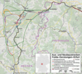
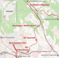
Neubaustrecke Frankfurt-Mannheim Karte.png 663 × 1,230; 989 KB
-
Neubaustrecke Rhein-Main-Rhein-Neckar Karte.svg 663 × 1,230; 6.9 MB
-
Railwaymap Kirchhain–Burg- und Nieder-Gemünden.png 3,769 × 2,981; 2.23 MB
-
Rechte Rheinstrecke map.png 800 × 600; 240 KB
-
Riedbahn.png 326 × 535; 94 KB
-
Schienennetzplan Frankfurt am Main.png 2,248 × 1,772; 242 KB
-
Schnellfahrstrecke Köln–RheinMain.png 1,023 × 856; 127 KB
-
Schnellfahrstrecke Köln–RheinMain.svg 1,559 × 1,304; 130 KB
-
SFS Koeln-Frankfurt.png 1,122 × 1,515; 110 KB
-
SFS-K-F.png 200 × 157; 3 KB
-
Sollingbahn01.png 1,233 × 725; 616 KB
-
Stadtbahn-wiesbaden-planung-2001-karte.svg 2,300 × 1,391; 2.46 MB
-
Umgehungsbahn mainz.png 1,930 × 1,277; 430 KB
-
Varianten der Kasseler Kurve.png 2,381 × 1,880; 1.98 MB
-
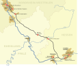
Verlauf der Neubaustrecke Frankfurt–Mannheim.svg 310 × 600; 2 KB
-
Verlaufskarte Scheldetalbahn.png 1,034 × 1,147; 1.03 MB


