Category:Rail transport maps of Saarland
Jump to navigation
Jump to search
Federal states of Germany:
Subcategories
This category has the following 2 subcategories, out of 2 total.
Media in category "Rail transport maps of Saarland"
The following 56 files are in this category, out of 56 total.
-
 Bahnstrecke Homburg–Neunkirchen.png 3,751 × 1,987; 1.24 MB
-
 Bahnstrecke Homburg–Zweibrücken.png 2,960 × 2,331; 1.96 MB
-
 Bahnstrecke Landau–Rohrbach.png 3,944 × 1,671; 2.24 MB
-
 Bahnstrecke Mannheim–Saarbrücken.png 3,564 × 1,521; 5.1 MB
-
 Bahnstrecke voeklingen grube puettlingen 1882.JPG 1,614 × 1,245; 607 KB
-
 Bahnstrecken Personenverkehr Rheinland-Pfalz und Saarland.svg 609 × 710; 3.22 MB
-
 Bliestalbahn.png 6,341 × 4,854; 4.47 MB
-
 DB 3010 railway map.png 1,563 × 1,161; 2.81 MB
-
 DB 3131 railway map.png 1,613 × 1,144; 1.33 MB
-
 DB 3201 railway map.png 1,377 × 1,016; 1.53 MB
-
 DB 3203 railway map.png 1,380 × 1,018; 1.17 MB
-
 DB 3204 railway map.png 1,508 × 1,098; 1.8 MB
-
 DB 3210 railway map.png 1,579 × 1,091; 773 KB
-
 DB 3211 railway map.png 1,266 × 939; 1.06 MB
-
 RFN 176 000.png 1,355 × 973; 1.03 MB
-
 RFN 175 000.png 1,500 × 1,078; 1.33 MB
-
 DB 3218 railway map.png 1,626 × 1,112; 1.58 MB
-
 DB 3221 railway map.png 1,327 × 892; 1.22 MB
-
 DB 3230 railway map.png 1,448 × 1,024; 1.85 MB
-
 RFN 172 000.png 1,419 × 1,020; 1.56 MB
-
 DB 3232 railway map.png 1,460 × 1,078; 1.75 MB
-
 DB 3235 railway map.png 1,343 × 974; 1.41 MB
-
 DB 3236 railway map.png 1,533 × 1,083; 1.42 MB
-
 DB 3240 railway map.png 1,484 × 1,047; 2.14 MB
-
 DB 3250 railway map.png 1,490 × 1,108; 1.52 MB
-
 DB 3251 railway map.png 1,528 × 1,088; 2.09 MB
-
 DB 3260 railway map.png 1,471 × 1,017; 1.81 MB
-
 DB 3274 railway map.png 1,404 × 1,002; 1.52 MB
-
 DB 3280 railway map.png 1,519 × 1,097; 1.86 MB
-
 DB 3281 railway map.png 1,470 × 1,066; 1.69 MB
-
 DB 3282 railway map.png 1,386 × 1,042; 1.49 MB
-
 DB 3283 railway map.png 1,351 × 960; 1.06 MB
-
 DB 3285 railway map.png 1,525 × 1,194; 1.4 MB
-
 RFN 174 000.png 1,389 × 1,031; 1.12 MB
-
 DB 3291 railway map.png 1,468 × 1,070; 1.41 MB
-
 DB 3511 railway map.png 1,646 × 1,203; 2.65 MB
-
 Hasseler Tunnel.png 1,900 × 1,200; 422 KB
-
 Hornbachbahn.png 2,114 × 3,545; 1.22 MB
-
 Karte der Bahnstrecke Saarbrücken–Trier int.png 1,500 × 2,089; 4.12 MB
-
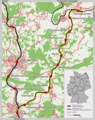
 Karte der Bahnstrecke Saarbrücken–Trier.png 1,500 × 2,082; 4.11 MB
-
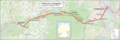
 Karte der Bahnstrecke Trier–Türkismühle.png 1,500 × 928; 284 KB
-
 Karte der Bahnstrecke Türkismühle–Kusel.png 1,998 × 983; 1.85 MB
-
 Karte der Nahetalbahn.png 1,100 × 1,204; 1.81 MB
-
 Karte Glantalbahn.nnw.png 1,661 × 2,302; 1.18 MB
-
 Liniennetz Süwex.png 1,033 × 858; 115 KB
-
 Liniennetzplan S-Bahn Saarland.pdf 10,972 × 7,779; 495 KB
-
 Map of the German railways, Sheet 43 Saarbrücken, May 1945 (148034566).png 4,743 × 4,172; 25.04 MB
-
 Nordfeldbahn.png 4,176 × 3,041; 1.21 MB
-
 Ostertalbahn.png 1,584 × 1,997; 1.57 MB
-
 Pfaelzische-ludwigsbahn.png 645 × 280; 125 KB
-
 Pfälzische Ludwigsbahn.png 3,846 × 1,296; 2.61 MB
-
 S-Bahn Saarland Zielnetz.png 10,044 × 7,468; 3.29 MB
-
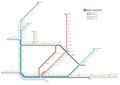
 S-Bahn-Netz Saarland.jpg 1,920 × 1,200; 181 KB
-
 Streckenkarte der Pfälzischen Ludwigsbahn.png 2,109 × 886; 1.25 MB
-
 Streckenkarte Fischbachtalbahn.png 1,500 × 1,212; 1.44 MB
-
 Würzbachbahn.png 3,815 × 2,586; 2.56 MB


.png)


