Category:Rail transport maps of Brandenburg
Jump to navigation
Jump to search
Federal states of Germany:
Subcategories
This category has only the following subcategory.
I
Media in category "Rail transport maps of Brandenburg"
The following 100 files are in this category, out of 100 total.
-
Abzw Glasomer Damm Eisenbahn Karte.svg 615 × 1,055; 787 KB
-
B-HH-Bahn-Map.jpg 1,107 × 586; 322 KB
-
Bahnhof Goehrde Stielers Handatlas 1891.jpg 1,000 × 682; 300 KB
-
Bahnhöfe in Berlin-Brandenburg.png 738 × 768; 177 KB
-
Bahnkarte Berlin Dresden.svg 205 × 514; 13.23 MB
-
Bahnstrecke Berlin Warschauer Straße–Königs Wusterhausen (Karte).svg 774 × 1,177; 4.16 MB
-
Bahnstrecke Berlin–Blankenheim Karte.png 2,601 × 2,379; 6.26 MB
-
Bahnstrecke Berlin–Dresden (Karte).jpg 2,242 × 2,463; 5.13 MB
-
Bahnstrecke Berlin–Görlitz Karte.png 1,846 × 2,680; 5.96 MB
-
Bahnstrecke Berlin–Magdeburg Karte.png 3,817 × 1,922; 6.59 MB
-
Bahnstrecke Berlin–Wriezen.png 3,713 × 2,064; 2.91 MB
-
Bahnstrecke Cottbus–Frankfurt (Oder) Karte.png 1,569 × 2,791; 3.52 MB
-
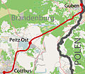
Bahnstrecke Cottbus–Guben (Karte).jpg 1,624 × 1,416; 1.26 MB
-
Bahnstrecke Falkenberg–Beeskow Karte.png 2,576 × 2,444; 5.28 MB
-
Bahnstrecke Großenhain–Cottbus Karte.png 2,347 × 2,342; 4.38 MB
-
Bahnstrecke Grunow–Königs Wusterhausen Karte.png 1,746 × 1,015; 1.7 MB
-
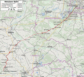
Bahnstrecke Halle–Cottbus (Karte).jpg 2,427 × 614; 1.41 MB
-
Bahnstrecke Jüterbog–Röderau (Karte).jpg 1,125 × 1,263; 1.3 MB
-
Bahnstrecke Knappenrode–Sornoer Buden.svg 1,447 × 1,001; 4.27 MB
-
Bahnstrecke Roßlau–Falkenberg (Karte).jpg 2,124 × 1,137; 1.87 MB
-
Bahnstrecke Salzwedel-Luechow 1892.jpg 662 × 392; 194 KB
-
Bahnstrecke Wriezen–Godków.png 2,510 × 2,274; 1.79 MB
-
Bahnstrecke Węgliniec–Falkenberg (Karte).jpg 2,076 × 641; 1.34 MB
-
Bahnstrecken Oderbruchbahn.png 2,760 × 3,126; 3.4 MB
-
Berlin - Görlitz Karte.png 800 × 950; 1.12 MB
-
Karte Berlin-Hamburger Bahn.png 1,452 × 1,086; 1.68 MB
-
Berliner Nordbahn Karte.png 800 × 1,250; 1.2 MB
-
Berliner Suedring BER.png 2,500 × 974; 232 KB
-
Breimeier-Trassee.png 2,904 × 1,141; 4.54 MB
-
Cottbus - Frankfurt Karte.png 800 × 600; 706 KB
-
Cottbus - Zary Karte.png 800 × 450; 418 KB
-
DB 1151 railway map.png 1,479 × 889; 1.75 MB
-
DB 6100 railway map.png 1,923 × 1,237; 2.58 MB
-
DB 6107 railway map.png 1,419 × 934; 1.73 MB
-
DB 6185 railway map.png 1,523 × 1,055; 2.21 MB
-
EGP-Gesamtnetz 2013-07.png 902 × 701; 95 KB
-
EGP-Gesamtnetz 2013.png 902 × 571; 87 KB
-
EGP-Gesamtnetz 2014.png 902 × 571; 87 KB
-
EGP-Gesamtnetz 2015.png 946 × 678; 100 KB
-
Falkenberg - Beeskow Karte.png 800 × 600; 709 KB
-
Fernverkehr berlin-brandenburg bahn.svg 721 × 741; 41 KB
-
Havelkanal & Sacrow-Paretzer Kanal.png 1,400 × 1,523; 918 KB
-
Karte Abzw Glasower Damm Eisenbahn.png 1,230 × 2,110; 760 KB
-
Karte Angermünde-Schwedter Eisenbahn.png 578 × 467; 144 KB
-
Karte Bahnstrecke Angermünde-Bad Freienwalde.png 756 × 1,023; 371 KB
-
Karte Bahnstrecke Berlin–Halle.png 1,666 × 1,854; 1.9 MB
-
Karte Bahnstrecke Berlin—Dresden.png 1,708 × 4,281; 2.27 MB
-
Karte Bahnstrecke Eberswalde-Frankfurt (Oder).png 2,304 × 561; 981 KB
-
Karte Bahnstrecke Küstrin–Frankfurt (Oder).png 1,632 × 2,684; 2.16 MB
-
Karte Bahnstrecke Wittenberge-Strasburg.png 1,507 × 817; 694 KB
-
Karte Berliner Nordbahn.png 1,465 × 3,503; 3.22 MB
-
Karte Berliner Nordbahn.svg 1,465 × 3,503; 4.09 MB
-
Karte der Bahnstrecke Buchholz - Wittenberge.png 3,400 × 914; 859 KB
-
Karte Klockow-Pasewalk.png 131 × 144; 42 KB
-
Karte Verkehrsprojekt Deutsche Einheit Nr. 8.png 748 × 1,011; 1.35 MB
-
Kreisbahn Rathenow-Nauen.png 1,838 × 750; 643 KB
-
Königlich Preußische Militäreisenbahn Karte.png 1,584 × 2,411; 3.38 MB
-
Lübbenau - Kamenz Karte.png 800 × 520; 633 KB
-
Map-of-295-and-6207-Węgliniec-Roßlau.png 1,279 × 880; 2.09 MB
-
Map-of-6205-Cottbus-Forst-State-border.png 1,520 × 881; 1.06 MB
-
Map-of-6207-State-border-Roßlau.png 1,279 × 880; 1.12 MB
-
Oberlausitzer Eisenbahn Streckennetz.png 600 × 306; 396 KB
-
PEG-Berlin.png 970 × 1,097; 76 KB
-
PEG-Liniennetz 2012.png 1,005 × 712; 112 KB
-
Potsdam Spandau Bahn Wasser.png 1,400 × 1,523; 919 KB
-
Preußische Ostbahn Karte Berlin.png 3,480 × 1,477; 4.09 MB
-
Priestewitz - Cottbus Karte.png 800 × 520; 634 KB
-
Railway-map-Germany-Angermuende-Stralsund.png 1,500 × 2,271; 2.3 MB
-
Rb36.svg 721 × 741; 85 KB
-
Rb93.svg 721 × 741; 80 KB
-
Re 1.svg 721 × 741; 84 KB
-
Re 10.svg 721 × 741; 81 KB
-
Re 15.svg 721 × 741; 80 KB
-
Re 18.svg 721 × 741; 80 KB
-
Re 2.svg 721 × 741; 83 KB
-
Re 3.svg 721 × 741; 84 KB
-
Re 4.svg 721 × 741; 82 KB
-
Re 5.svg 721 × 741; 84 KB
-
Re 6.svg 721 × 741; 84 KB
-
Re 7.svg 721 × 741; 82 KB
-
RE1-16.svg 741 × 861; 76 KB
-
RE10-16.svg 741 × 861; 76 KB
-
RE15-16.svg 741 × 861; 76 KB
-
RE18-16.svg 741 × 861; 76 KB
-
RE2-16.svg 741 × 861; 76 KB
-
RE3-16.svg 741 × 861; 76 KB
-
RE4-16.svg 741 × 861; 76 KB
-
RE5-16.svg 741 × 861; 76 KB
-
RE6-16.svg 741 × 861; 76 KB
-
RE7-16.svg 741 × 861; 76 KB
-
SFS Hamburg-Berlin.png 1,122 × 1,515; 110 KB
-
SFS Hannover-Berlin.png 1,122 × 1,515; 108 KB
-
Stammbahn Karte.png 850 × 500; 648 KB
-
Streckenkarte der Stettiner Bahn.png 1,732 × 1,936; 1.87 MB
-
Streckenverlauf RSN.jpg 955 × 341; 28 KB
-
Umgehungsbahn Karte.png 850 × 500; 619 KB
-
Weißwasser - Forst Karte.png 800 × 450; 418 KB
-
Wriezener Bahn Karte.png 975 × 600; 494 KB
-
Zugstrecke Berlin-Halle Verlauf.png 145 × 138; 3 KB


