Category:Rail transport maps of Dresden
Jump to navigation
Jump to search
Media in category "Rail transport maps of Dresden"
The following 18 files are in this category, out of 18 total.
-
BahnhofDresdenFriedrichstadtStadtplan1900.jpg 2,498 × 1,136; 1.11 MB
-
DD-Albertbahn-4.jpg 1,189 × 1,585; 815 KB
-
Dresden Elbezweigbahn Topografische Karte 1904.png 767 × 1,698; 2.84 MB
-
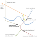
DresdenBahnlinienSchema.png 720 × 720; 35 KB
-
DresdenBöhmischerBahnhofStadtplan1851.gif 560 × 544; 312 KB
-
DresdenLeipzigerBahnhofLageplan1839.png 4,609 × 2,036; 697 KB
-
Elbezweigbahn Dresden Karte 1910.png 1,746 × 3,000; 11.57 MB
-
Entwurfplanung Bahnhof Dresden-Neustadt1895.jpg 3,245 × 4,302; 12.48 MB
-
Hafenbahn Dresden Karte 1910.png 2,999 × 1,929; 9.36 MB
-
Karte Albertsbahn.jpg 2,430 × 2,123; 1.31 MB
-
Karte der Windbergbahn.png 1,505 × 2,040; 1.26 MB
-
Lageplan Leipziger Bahnhof und Schlesischer Bahnhof Dresden1852.jpg 2,939 × 3,262; 2.88 MB
-
Map of railway station dresden-friedrichstadt - d.jpg 8,697 × 4,650; 3.79 MB
-
Neuester Grundriss von Dresden 01.jpg 3,825 × 2,728; 2.2 MB
-
SBS-Liniennetz 2014.png 1,024 × 967; 110 KB
-
SBS-Liniennetz 2017.svg 533 × 533; 6 KB
-
Trümmerbahn 1946-58.jpg 4,442 × 3,141; 1.28 MB
-
Verlauf der Strecke 6607.png 1,617 × 849; 1,017 KB


