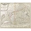
Category:Old maps of the canton of Bern
Jump to navigation
Jump to search
Cantons of Switzerland: Aargau (AG) · Basel-Stadt (BS) · Basel-Landschaft (BL) · Bern (BE) · Fribourg (FR) · Geneva (GE) · Graubünden (GR) · Jura (JU) · Luzern (LU) · Schwyz (SZ) · Solothurn (SO) · St. Gallen (SG) · Thurgau (TG) · Ticino (TI) · Valais (VS) · Vaud (VD) · Zürich (ZH)
Subcategories
This category has the following 2 subcategories, out of 2 total.
C
Media in category "Old maps of the canton of Bern"
The following 18 files are in this category, out of 18 total.
-
Bernensis.jpg 7,203 × 5,100; 56.62 MB
-
Walser, Canton Bern, 1766.jpg 3,000 × 3,000; 1.34 MB
-
Abregé de Canton de Berne fait par le General Brune (BM 1878,1214.215).jpg 1,570 × 2,100; 835 KB
-
Zentralbibliothek Solothurn - Des KANTONS BERN NöRDLICHER THEIL Nro 394 - aa0070.tif 3,426 × 2,446; 24 MB
-
Swisstopo Dufourkarte BLATT XVII VEVEY SION LT TK 017 1844.tiff 11,151 × 8,600; 93.87 MB
-
Karte des Deutschen Reiches (5820669c).jpg 12,345 × 9,263; 55.19 MB
-
Karte Bern, altes Staatsgebiet - Staatsarchiv Bern AA 1759.jpg 7,519 × 5,365; 5.4 MB
-
Schöpfkarte 1578 - Ausschnitt um Bern.png 726 × 502; 872 KB
-
UBBasel Map Kanton Bern 1672 Kartenslg Schw Cb 2.tif 33,511 × 7,889, 4 pages; 2.98 GB
-
UBBasel Map Kanton Bern 1672 Kartenslg Schw Cb 3.tif 13,049 × 9,032, 9 pages; 2.96 GB
-
UBBasel Map Kanton Bern 1672 Kartenslg Schw Cb 4.tif 17,790 × 9,141, 6 pages; 2.78 GB
-
UBBasel Map Kanton Bern Rheinland 1638 Kartenslg Schw Cb 5.tif 11,272 × 7,558, 2 pages; 243.77 MB
-
UBBasel Map Kanton Bern Rheinland 1638 Kartenslg Schw Cb 6.tif 11,807 × 9,002, 2 pages; 304.11 MB
-
UBBasel Map Kanton Bern Rheinland 1638 Kartenslg Schw Cb 6a.tif 10,961 × 7,220, 2 pages; 226.44 MB


