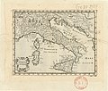
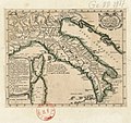
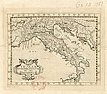
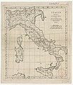
Category:Old maps of Italy
Jump to navigation
Jump to search
Use the appropriate category for maps showing all or a large part of Italy. See subcategories for smaller areas:
| If the map shows | Category to use |
|---|---|
| Italy on a recently created map | Category:Maps of Italy or its subcategories |
| Italy on a map created more than 70 years ago | Category:Old maps of Italy or its subcategories |
| the history of Italy on a recently created map | Category:Maps of the history of Italy or its subcategories |
| the history of Italy on a map created more than 70 years ago | Category:Old maps of the history of Italy or its subcategories |
Subcategories
This category has the following 17 subcategories, out of 17 total.
Media in category "Old maps of Italy"
The following 200 files are in this category, out of 324 total.
(previous page) (next page)-
0 Italie - Corse - Sardaigne - Galleria delle carte geografiche.JPG 3,224 × 2,588; 3.85 MB
-
Europe 526-600.jpg 907 × 1,427; 410 KB
-
SalernoPrincipato annomille.jpg 411 × 441; 56 KB
-
105 of 'Pröver paa en Jordbeskrivelse' (11037677284).jpg 2,448 × 3,069; 1.25 MB
-
12 of 'L'Italia geografica illustrata, etc' (11208825055).jpg 4,252 × 5,433; 5.41 MB
-
Cales nell'Italia di Tolomeo.jpg 1,538 × 1,084; 1.23 MB
-
Sixth map of Europe (Italy, Corsica), in full gold border (NYPL b12455533-427023).tif 4,928 × 3,845; 54.43 MB
-
Bodleian Libraries, Italy.jpg 1,000 × 675; 125 KB
-
Sexta Europa Tabula.jpg 10,312 × 7,280; 25.58 MB
-
Tabula Sexta dEuropa.jpg 597 × 499; 108 KB
-
Sexta Europae tabula (7537878890).jpg 2,000 × 1,518; 3.11 MB
-
Sexta Europae Tabula.jpg 4,658 × 3,636; 2.63 MB
-
ImperiiCaroliMagni.jpg 5,500 × 3,726; 2.44 MB
-
1827 Finley Map of Italy - Geographicus - Italy-finley-1827.jpg 2,347 × 3,000; 2.11 MB
-
1865 Spruner Map of Italy under Augustus Caesar - Geographicus - Italia-spruner-1865.jpg 3,500 × 2,766; 2.59 MB
-
19 of 'Italy and the Italians. ... With map and illustrations' (11245493463).jpg 1,481 × 2,169; 672 KB
-
Heinrich Kiepert. Italiae pars media.jpg 7,143 × 5,672; 8.42 MB
-
Italien 1905 (cropped).png 169 × 183; 23 KB
-
Italien 1905.png 1,471 × 2,000; 1.68 MB
-
284 of 'Viaggio antiquario ne'contorni di Roma' (11004243196).jpg 2,986 × 2,468; 1.57 MB
-
299 of 'Die Erde. Eine allgemeine Erd- und Länderkunde, etc' (11234853596).jpg 1,135 × 2,387; 784 KB
-
91 of 'Cassell's Illustrated Universal History' (11155489474).jpg 2,912 × 1,915; 1.16 MB
-
A complete geographical dictionary Fleuron T112946-6.png 1,457 × 1,378; 131 KB
-
A general history for colleges and high schools (1889) (14578050648).jpg 3,280 × 2,008; 914 KB
-
A general history for colleges and high schools (1889) (14741682646).jpg 3,296 × 2,092; 1.03 MB
-
A map of Italy Wellcome V0049914.jpg 3,434 × 2,388; 4.01 MB
-
A new map of Italy, distinguishing all the sovereignties in it, ... NYPL1630452.tiff 7,230 × 5,116; 105.83 MB
-
A trip through Italy, Sicily, Tunisia, Algeria and southern France (1918) (14759165696).jpg 3,044 × 2,204; 1.26 MB
-
Ali Macar Reis'in kent ve kaleleri gösteren İtalya haritası.jpg 422 × 611; 524 KB
-
Angelo Celli, Malaria according to the new researches Wellcome L0026233.jpg 1,255 × 1,624; 728 KB
-
Atlas Ortelius KB PPN369376781-059av-059br.jpg 3,000 × 2,194; 4.83 MB
-
Atlas Ortelius KB PPN369376781-070av-070br.jpg 3,000 × 2,194; 4.94 MB
-
Atlas Van der Hagen-KW1049B12 049-TOTIUS ITALIAE TABULA.jpeg 5,500 × 4,537; 4.2 MB
-
Atlas Van der Hagen-KW1049B12 079-REGNO DI NAPOLI.jpeg 5,500 × 4,298; 3.74 MB
-
Dominii Veneti in Italia (NYPL b13654243-psnypl map 311).tiff 5,366 × 4,810; 73.85 MB
-
Italia (NYPL b15404146-1632188).jpg 7,230 × 5,428; 6.67 MB
-
Bartholomew's war map of Italy and the Balkan States (5008442).jpg 5,000 × 3,756; 4.16 MB
-
Beloch - Italia ante bellum Marsicum.png 2,852 × 2,352; 3.37 MB
-
Bollettino del R. Comitato geologico d'Italia. (1919) (20398437141).jpg 3,424 × 3,028; 3.22 MB
-
Bollettino del R. Comitato geologico d'Italia. (1920) (20365977866).jpg 2,784 × 2,844; 3.35 MB
-
Bouillet - Atlas universel, Carte 70.png 2,683 × 3,425; 10.75 MB
-
Brockhaus and Efron Jewish Encyclopedia e8 483-0.jpg 1,091 × 1,619; 232 KB
-
Carta postale e stradale dell'Italia LOC 2018588026.jpg 9,398 × 9,021; 17.87 MB
-
Carta postale e stradale dell'Italia LOC 2018588026.tif 9,398 × 9,021; 242.56 MB
-
Cartapisana cz.jpg 3,334 × 2,349; 1.39 MB
-
Carte du Voyage - Godard - Faultrier Victor - 1857.jpg 1,500 × 1,173; 395 KB
-
Carte Générale De L'Italie.jpg 9,738 × 7,044; 18.09 MB
-
Carte italie 1843.jpg 2,483 × 3,389; 4.18 MB
-
Carte Pisane Portolan.jpg 3,481 × 1,848; 2.15 MB
-
Carte von Alt Italien.jpg 4,428 × 6,008; 8.64 MB
-
Cartiglio cluver 1672.jpg 294 × 316; 36 KB
-
Cartografie in Nederland, kaart van Italië, NG-501-51.jpg 5,874 × 4,826; 4.95 MB
-
Charte von Italien (5376031450).jpg 861 × 1,024; 767 KB
-
Coppo italia.jpg 1,000 × 714; 261 KB
-
Crusades 1905.jpg 1,468 × 1,176; 252 KB
-
Defense Overlay - Foce del Pescara - DPLA - aa64b0f1797e71239c47b27e093c1a7f.jpg 4,136 × 5,625; 2.25 MB
-
Defense Overlay - Porto Recanati - DPLA - af1d7be32a8270fbaac2e4f3413d340c.jpg 3,816 × 5,330; 1.73 MB
-
Dep-fr-it.jpg 741 × 756; 415 KB
-
Esquisse d'une carte géologique d'Italie.jpg 7,552 × 10,112; 44.59 MB
-
Ethnographische Panoramaskizze durch das antike Etrurien mit Verortung der Stämme 02.jpg 7,919 × 6,197; 10.17 MB
-
Ethnographische Panoramaskizze durch das antike Etrurien mit Verortung der Stämme.jpg 7,911 × 6,212; 9.37 MB
-
Europe 526-600 japref.jpg 900 × 1,400; 325 KB
-
Europe since 1815 (1910) (14764830605).jpg 1,822 × 2,900; 622 KB
-
Fermorestando Italia.webm 3 min 22 s, 640 × 480; 9.14 MB
-
Fifty years of Europe, 1870-1919 (1919) (14597434069).jpg 1,206 × 1,992; 591 KB
-
Fossalta 1892.jpg 2,480 × 3,507; 2.85 MB
-
Fürstentum tarent 1250.jpg 5,500 × 4,298; 13.06 MB
-
General Karte von Italien. 1-1 850 000... (2 Auflage) - von F. Handtke - btv1b53021211s.jpg 10,118 × 9,850; 16.35 MB
-
General-Karte von Italien... (2 Auflage) - gezeichnet von F. Handtke - btv1b53022719m.jpg 11,689 × 9,556; 17.1 MB
-
Girolamo ruscelli, carta tolemaica dell'italia (tabula V), venezia 1561-64 ca.jpg 3,714 × 2,646; 4.99 MB
-
Guide to Italy and Sicily (1911) (14579376209).jpg 2,880 × 4,060; 2.64 MB
-
Guide to Italy and Sicily (1911) (14743011486).jpg 2,828 × 2,876; 1.85 MB
-
Guide to Italy and Sicily (1911) (14762844511).jpg 4,164 × 2,776; 2.67 MB
-
Guide to Italy and Sicily (1911) (14766019555).jpg 4,764 × 2,864; 2.95 MB
-
Guide to Italy and Sicily (1911) (14785892713).jpg 4,384 × 2,824; 2.65 MB
-
Heinrich Kiepert. Italia. Undecim regiones Italiae ab Augusto Imp. institutae.jpg 5,567 × 6,949; 6.97 MB
-
Historische kaart van Griekenland en Italië, RP-P-1936-265.jpg 5,124 × 4,292; 3.17 MB
-
Italia - btv1b53042051n.jpg 5,297 × 4,233; 5.5 MB
-
Italia - btv1b530430226.jpg 7,960 × 6,083; 8.14 MB
-
Italia - da Giacomo Gastaldi - btv1b53223616s.jpg 11,906 × 7,710; 12.8 MB
-
Italia - di Matteo Greuter... - btv1b525056959 (13 of 24).jpg 10,294 × 7,734; 10.61 MB
-
Italia - disegnata da Carlo Cerri... - btv1b53023112j.jpg 14,916 × 19,129; 58.17 MB
-
Italia - Gli Stati d´Italia.jpg 7,402 × 6,308; 15.88 MB
-
Italia antica - di Cl. Tolomeo - btv1b5963841x.jpg 5,968 × 4,624; 5.01 MB
-
Italia antiqua - auctore d'Anville ; Ancient Italy, by d'Anville - btv1b8469297h.jpg 9,154 × 10,296; 15.31 MB
-
Italia antiqua - btv1b5963847d.jpg 2,808 × 2,384; 1.01 MB
-
Italia Augustiniana ... cum conventibus distributa - btv1b530431019.jpg 7,828 × 6,050; 7.39 MB
-
Italia benedictina - delineata A.P.R.C.P.W. - btv1b530429908.jpg 7,837 × 6,039; 7.73 MB
-
Italia Benedictina - delineata A.P.R.C.P.W. - btv1b59719215.jpg 6,944 × 5,872; 4.77 MB
-
Italia cum insulis et regionibus finitimis (8346580788).jpg 557 × 800; 104 KB
-
Italia cursoria seu Tabula geographica ... - a Joanne Bapt. Homanno - btv1b53042512b.jpg 7,873 × 6,050; 7.56 MB
-
Italia di marmo (3093248342).jpg 886 × 1,181; 1.1 MB
-
Italia geografica, statistica e postale - btv1b6500029c.jpg 4,096 × 5,960; 4.65 MB
-
Italia novamente posta in luce da molti errori emendata - btv1b55004766w.jpg 7,995 × 6,154; 5.62 MB
-
Italia Novamente posta in luce et da molti errori emendata - btv1b53223618p.jpg 6,996 × 5,146; 6.25 MB
-
Italia Novamete posta in luce et da molti errori emendata - btv1b8494696r.jpg 9,091 × 6,407; 10.43 MB
-
Italia Nuova - btv1b52511438b.jpg 10,357 × 9,372; 10.24 MB
-
Italia nuova - de Gio. Antonio Magini ; Giusto Sadeler - btv1b530396227.jpg 13,665 × 10,800; 29.13 MB
-
Italia nuova di Gio Antonio Magini - btv1b55011017w.jpg 18,215 × 12,064; 39.31 MB
-
Italia nuova-Domenego Veneziano fece - btv1b8492009w.jpg 9,276 × 7,342; 11.25 MB
-
Italia XXIII provincias Capucinorum continens conventus ... - btv1b53212210x.jpg 4,274 × 2,882; 2.66 MB
-
Italia, novamente piu perfetta che mai per anzi posta in luce... - btv1b8468319b.jpg 8,041 × 6,046; 8.44 MB
-
Italia. Parte occidentale - Dal P. Coronelli - btv1b6500006c.jpg 4,096 × 5,413; 4.01 MB
-
Italia. Parte orientale - Dal P. Coronelli - btv1b6500007s.jpg 4,096 × 5,451; 3.91 MB
-
Italiae Antiquae Tabula - Spinellus delin. ; Ioan. Leopold Mayr sculp. - btv1b59627559.jpg 9,336 × 6,760; 9.21 MB
-
Italiae divisio per Augustum in XI regiones - btv1b59638519.jpg 2,592 × 2,280; 887 KB
-
Italiae divisio secudum imperii notitiam - btv1b59638534.jpg 2,864 × 2,344; 1.04 MB
-
Italiae typus - ab Anvillaeo delineatus - btv1b59638497.jpg 3,936 × 4,336; 2.19 MB
-
Italiae typus - ab Anvillaeo delineatus - btv1b5963850w.jpg 3,048 × 3,560; 1.72 MB
-
Italie - btv1b530782467.jpg 5,622 × 4,671; 4.55 MB
-
Italie - dressée par le chevalier Lapie... - btv1b53093680m.jpg 6,619 × 9,546; 11.04 MB
-
Italie - Dufour, A.H. - btv1b10567618k.jpg 7,221 × 9,524; 11.67 MB
-
Italie ad uso delle scuole del regno 1879 - btv1b53060405t.jpg 12,200 × 14,910; 27.85 MB
-
Italie ancienne - btv1b55011141t.jpg 4,513 × 4,075; 3.39 MB
-
Italien BV043420662.jpg 1,771 × 2,404; 546 KB
-
Italien by Carl Flemming.jpg 5,475 × 4,477; 8.87 MB
-
Italy, and Sardinia, from the best authorities (3046076558).jpg 2,000 × 1,680; 3.01 MB
-
Italy- a handbook for travellers. First Part (Nothern Italy) (1893) (14594624130).jpg 2,744 × 1,824; 1.65 MB
-
Italy- a handbook for travellers. First Part (Nothern Italy) (1893) (14594724937).jpg 2,642 × 1,728; 2.42 MB
-
Italy- a handbook for travellers. First Part (Nothern Italy) (1893) (14594930869).jpg 3,396 × 3,566; 4.69 MB
-
Italy- a handbook for travellers. First Part (Nothern Italy) (1893) (14594935109).jpg 2,762 × 1,904; 1.82 MB
-
Italy- a handbook for travellers. First Part (Nothern Italy) (1893) (14595097077).jpg 2,762 × 1,920; 1.4 MB
-
Italy- a handbook for travellers. First Part (Nothern Italy) (1893) (14758533466).jpg 2,656 × 1,816; 2.69 MB
-
Italy- a handbook for travellers. First Part (Nothern Italy) (1893) (14781027522).jpg 1,720 × 2,542; 1.96 MB
-
Italy- a handbook for travellers. First Part (Nothern Italy) (1893) (14781335145).jpg 2,826 × 1,904; 2.42 MB
-
Italy- a handbook for travellers. First Part (Nothern Italy) (1893) (14801196233).jpg 3,008 × 1,832; 2.3 MB
-
Italy.gif 350 × 391; 88 KB
-
Italy; handbook for travellers (1900) (14784523832).jpg 2,384 × 2,017; 717 KB
-
Itália térképe a Jirka könyvből.jpg 1,338 × 1,928; 932 KB
-
John speed per george humble, italia newly augmented, 1626, stampa acquarellata 01.jpg 3,534 × 2,742; 6.3 MB
-
Karta över Italien, 1664 - Skoklosters slott - 97989.tif 4,839 × 3,744; 51.85 MB
-
Karte der Dolomitalpen.jpg 10,370 × 8,107; 31.44 MB
-
Kriegstheater oder Graenzkarte Zwischen Frankreich und Italien.jpg 7,304 × 6,474; 16.3 MB
-
L'aes grave del Museo Kircheriano 142-143.jpg 3,872 × 2,592; 8.8 MB
-
L'Italia - descritta da Giacomo Cantelli - btv1b53042580b.jpg 7,969 × 6,053; 8.54 MB
-
L'Italie artiste au XVe siècle - btv1b8439742f.jpg 4,438 × 5,588; 3.08 MB
-
L'Italie artiste au XVe siècle - btv1b8440538b.jpg 4,788 × 6,482; 3.58 MB
-
L'Italie au XIIe siècle - btv1b55011157x.jpg 4,495 × 3,481; 2.88 MB
-
L'Italie divisée en ses Estats - par ...de Fer ; gravé par Starckman - btv1b53042995h.jpg 7,881 × 6,070; 7.42 MB


