Category:National Atlas of the United States
Jump to navigation
Jump to search
English: Maps and other images from the National Atlas of the United States.
former national atlas (1874-1997) | |||||
| Upload media | |||||
| Instance of |
| ||||
|---|---|---|---|---|---|
| Country of origin | |||||
| Inception |
| ||||
| Dissolved, abolished or demolished date |
| ||||
| |||||
Subcategories
This category has the following 53 subcategories, out of 53 total.
- PD Atlas (1707 F)
1
A
- National Atlas maps of Arizona (10 F)
C
D
F
- National Atlas maps of Florida (14 F)
H
I
- National Atlas maps of Idaho (5 F)
- National Atlas maps of Iowa (3 F)
K
- National Atlas maps of Kentucky (10 F)
L
- National Atlas maps of Louisiana (16 F)
M
- National Atlas maps of Maine (6 F)
N
O
- National Atlas maps of Ohio (29 F)
P
T
- National Atlas maps of Tennessee (14 F)
- National Atlas maps of Texas (5 F)
U
- National Atlas maps of Utah (3 F)
V
Media in category "National Atlas of the United States"
The following 63 files are in this category, out of 63 total.
-
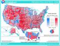
 08 elect13.svg 1,019 × 780; 1.72 MB
-
 2008 party vote county.pdf 1,591 × 1,218; 13.15 MB
-
 Average precipitation in the lower 48 states of the USA.png 2,785 × 1,873; 2.19 MB
-
 Baker Island 2.jpg 262 × 190; 52 KB
-
 Bikini Atoll 2.jpg 371 × 281; 83 KB
-
 Canton Island 2.jpg 327 × 398; 85 KB
-
 Congressional districts.gif 792 × 612; 85 KB
-
 Enderbury Atoll.jpg 328 × 191; 54 KB
-
 Eniwetok Atoll.jpg 372 × 411; 101 KB
-
 Genref-national-atlas.gif 588 × 450; 137 KB
-
 Guam 22.jpg 1,205 × 1,500; 523 KB
-
 Howland Island 2.jpg 314 × 189; 54 KB
-
 Jaluit Atoll.jpg 371 × 508; 106 KB
-
 Jarvis Island 2.jpg 264 × 191; 53 KB
-
 Johnston Atoll 2.jpg 316 × 395; 74 KB
-
 Kingman Reef 2.jpg 404 × 315; 73 KB
-
 Kusaie (Kosrae).jpg 497 × 166; 63 KB
-
 Kwajalein Atoll 2.jpg 755 × 699; 197 KB
-
 Majuro and Arno Atolls 2.jpg 753 × 493; 164 KB
-
 Majuro and Arno Atolls.jpg 754 × 493; 166 KB
-
 Manua Islands.jpg 726 × 394; 130 KB
-
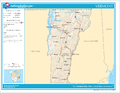 Map of Vermont NA.png 2,122 × 1,640; 1.05 MB
-
 Map of Virgin Islands NA.png 2,122 × 1,640; 359 KB
-
 Midway Islands 2.jpg 315 × 314; 79 KB
-
 National Atlas logo.png 81 × 92; 1 KB
-
 National Atlas Mercator.gif 280 × 164; 12 KB
-
 National Atlas of the United States Logo.svg 243 × 278; 8 KB
-
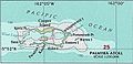
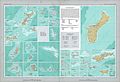 National Atlas of the USA 1970 - Pacific Outlying Areas.jpg 4,170 × 2,836; 2.04 MB
-
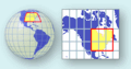 National Atlas Projection.gif 260 × 136; 13 KB
-
 National Atlas.gif 589 × 450; 63 KB
-
 National-atlas-1970-1810-loupurchase.png 477 × 302; 76 KB
-
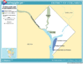 National-atlas-district-of-columbia.gif 764 × 610; 46 KB
-
 National-atlas-general-reference-map-USA.png 735 × 495; 138 KB
-
 National-atlas-puerto-rico-virgin-islands.png 764 × 583; 88 KB
-
 National-atlas-states-brightcolors.png 764 × 585; 53 KB
-
 National-atlas-timezones-2006.gif 589 × 450; 44 KB
-
 National-atlas-usa-rivers-unlabeled.png 758 × 584; 171 KB
-
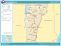 National-atlas-vermont.png 763 × 586; 82 KB
-
 Pagecgd109 us3.gif 588 × 450; 66 KB
-
 Palau Islands.jpg 634 × 697; 144 KB
-
 Palmyra Atoll 2.jpg 402 × 194; 69 KB
-
 Rose and Sand Islands.jpg 209 × 198; 53 KB
-
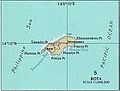 Rota 2.jpg 371 × 282; 71 KB
-
 Saipan and Tinian 2.jpg 371 × 413; 98 KB
-
 Senyavin Islands.jpg 493 × 318; 102 KB
-
 Swains Island.jpg 211 × 183; 52 KB
-
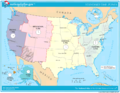 TimeZonesUSA large.png 1,187 × 915; 107 KB
-
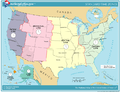 TimeZonesUSA.png 765 × 584; 145 KB
-
 Truk Islands (cropped).jpg 632 × 493; 152 KB
-
 Truk Islands.jpg 634 × 491; 153 KB
-
 Tutuila Island.jpg 814 × 519; 188 KB
-
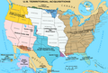 U.S. Territorial Acquisitions.png 1,536 × 1,038; 1.11 MB
-
 Ulithi Atoll.jpg 494 × 383; 104 KB
-
 United states wall 2002 us.jpg 4,800 × 3,140; 2.81 MB
-
 UnitedStatesExpansion.png 6,154 × 4,164; 4.47 MB
-
 US-Timezones.svg 1,238 × 956; 7.19 MB
-
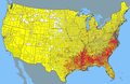 USA 2000 Black Density.PNG 762 × 494; 685 KB
-
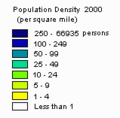 USA 2000 population density key.png 159 × 157; 762 bytes
-
 USA 2000 population density.jpg 760 × 498; 70 KB
-
 USA 2000 population density.png 860 × 545; 38 KB
-
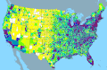 USA-2000-population-density.gif 907 × 592; 57 KB
-
 Wake Island 2.jpg 330 × 317; 69 KB
-
 Yap Islands 2.jpg 492 × 303; 84 KB


.jpg)


.jpg)