Category:National Atlas maps of Michigan
Jump to navigation
Jump to search
States of the United States: Alabama · Alaska · Arizona · Arkansas · California · Colorado · Connecticut · Delaware · Florida · Georgia · Hawaii · Idaho · Illinois · Indiana · Iowa · Kansas · Kentucky · Louisiana · Maine · Maryland · Massachusetts · Michigan · Minnesota · Mississippi · Missouri · Montana · Nebraska · Nevada · New Hampshire · New Jersey · New Mexico · New York · North Carolina · North Dakota · Ohio · Oklahoma · Oregon · Pennsylvania · Rhode Island · South Carolina · South Dakota · Tennessee · Texas · Utah · Virginia · Washington · West Virginia · Wisconsin · Wyoming
United States Virgin Islands
United States Virgin Islands
Media in category "National Atlas maps of Michigan"
The following 4 files are in this category, out of 4 total.
-
 Average precipitation in Michigan.png 1,166 × 890; 305 KB
-
 Map of Michigan NA.png 2,122 × 1,640; 1.21 MB
-
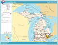 National-atlas-michigan.png 762 × 586; 76 KB
-
 Pagecgd112 mi.pdf 1,650 × 1,275; 820 KB


