Category:National Atlas maps of Kentucky
Jump to navigation
Jump to search
States of the United States: Alabama · Alaska · Arizona · Arkansas · California · Colorado · Connecticut · Delaware · Florida · Georgia · Hawaii · Idaho · Illinois · Indiana · Iowa · Kansas · Kentucky · Louisiana · Maine · Maryland · Massachusetts · Michigan · Minnesota · Mississippi · Missouri · Montana · Nebraska · Nevada · New Hampshire · New Jersey · New Mexico · New York · North Carolina · North Dakota · Ohio · Oklahoma · Oregon · Pennsylvania · Rhode Island · South Carolina · South Dakota · Tennessee · Texas · Utah · Virginia · Washington · West Virginia · Wisconsin · Wyoming
United States Virgin Islands
United States Virgin Islands
Media in category "National Atlas maps of Kentucky"
The following 10 files are in this category, out of 10 total.
-
 KY01 109.PNG 636 × 379; 39 KB
-
 KY02 109.PNG 635 × 379; 43 KB
-
 Ky03 109 cropped.png 347 × 258; 18 KB
-
 KY04 109.PNG 635 × 380; 38 KB
-
 KY05 109.PNG 635 × 380; 41 KB
-
 KY06 109.PNG 635 × 379; 40 KB
-
 Map of Kentucky NA (cropped).png 1,562 × 1,101; 1.12 MB
-
 Map of Kentucky NA.png 2,122 × 1,640; 1.36 MB
-
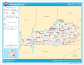
 National-atlas-kentucky.png 801 × 620; 81 KB
-
 Precipitation of Kentucky.png 2,122 × 1,640; 479 KB


.png)


