Category:National Atlas maps of Oregon
Jump to navigation
Jump to search
States of the United States: Alabama · Alaska · Arizona · Arkansas · California · Colorado · Connecticut · Delaware · Florida · Georgia · Hawaii · Idaho · Illinois · Indiana · Iowa · Kansas · Kentucky · Louisiana · Maine · Maryland · Massachusetts · Michigan · Minnesota · Mississippi · Missouri · Montana · Nebraska · Nevada · New Hampshire · New Jersey · New Mexico · New York · North Carolina · North Dakota · Ohio · Oklahoma · Oregon · Pennsylvania · Rhode Island · South Carolina · South Dakota · Tennessee · Texas · Utah · Virginia · Washington · West Virginia · Wisconsin · Wyoming
United States Virgin Islands
United States Virgin Islands
Media in category "National Atlas maps of Oregon"
The following 6 files are in this category, out of 6 total.
-
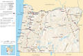
 High Desert Discovery Scenic Byway map.jpg 593 × 469; 128 KB
-
 Map of Oregon NA.png 1,967 × 1,331; 2.15 MB
-
 National-atlas-oregon.png 763 × 590; 149 KB
-
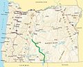 Oregon Outback Scenic Byway map.jpg 590 × 473; 123 KB
-
 Small-Oregon-Map.png 546 × 696; 558 KB
-
 Wpdms na-or wcascadesbyway.png 588 × 491; 377 KB


