Category:Maps of the imperial circles
Jump to navigation
Jump to search
Subcategories
This category has the following 10 subcategories, out of 10 total.
A
B
E
F
L
S
U
Media in category "Maps of the imperial circles"
The following 38 files are in this category, out of 38 total.
-
Holy Roman Empire divided into its Circles.jpg 1,276 × 960; 659 KB
-
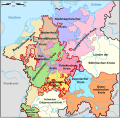
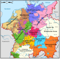
Karte Vordere Reichskreise.svg 699 × 684; 210 KB
-
Kreiseinteilung Deutsches Reich (1521-1806).jpg 1,628 × 1,361; 1.59 MB
-
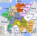
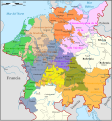
Map of the Imperial Circles (1512)-bg.png 610 × 599; 253 KB
-
Map of the Imperial Circles (1512)-de.png 727 × 714; 67 KB
-
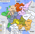
Map of the Imperial Circles (1512)-en.png 610 × 599; 321 KB
-
Map of the Imperial Circles (1512)-es.svg 727 × 714; 596 KB
-
Map of the Imperial Circles (1512)-fr.svg 727 × 714; 534 KB
-
Map of the Imperial Circles (1560)-de.svg 708 × 691; 149 KB
-
Map of the Imperial Circles (1560)-en.svg 1,165 × 1,140; 336 KB
-
Map of the Imperial Circles (1560)-es.svg 1,165 × 1,140; 1.92 MB
-
Map of the Imperial Circles (1560)-la.svg 1,165 × 1,140; 285 KB
-
Map of the Imperial Circles (1560)-nl.svg 1,165 × 1,140; 342 KB
-
Map of the Imperial Circles 1512-es.svg 1,165 × 1,253; 1.93 MB
-
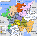
Német-római Birodalom körzetei (1512).png 610 × 599; 259 KB
-
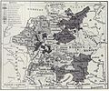
Deutsches Reich - Reichskreiseinteilung 1500.jpg 550 × 1,118; 329 KB
-
Reichskreise.jpg 550 × 1,118; 160 KB
-
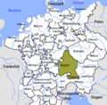
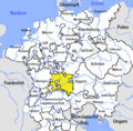
Bavarian Circle-2005-10-15-en.png 727 × 714; 67 KB
-
Bavarian Circle-2005-10-15-de.png 727 × 714; 67 KB
-
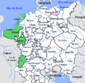
Burgundian Circle-2005-10-15-fr.png 727 × 714; 68 KB
-
C. 1512 Holy Roman Empire.jpg 1,341 × 1,355; 1.69 MB
-
Electoral Rhenish Circle-2005-10-15-en.png 727 × 714; 67 KB
-
Electoral Rhenish Circle-2005-10-15-hu.PNG 610 × 599; 211 KB
-
Franconian Circle-2005-10-15-en.png 727 × 714; 67 KB
-
Imperial circles of Germany (Johnston).jpg 790 × 1,067; 711 KB
-
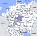
Lower Rhenish-Westphalian Circle-2005-10-15-de.png 727 × 714; 66 KB
-
Lower Rhenish-Westphalian Circle-2005-10-15-en.png 727 × 714; 67 KB
-
Map of the Imperial Circles (1512)-ca.svg 727 × 714; 634 KB
-
Map of the Imperial Circles (1560)-ca.svg 1,165 × 1,140; 2.17 MB
-
Putz27.jpg 3,641 × 2,848; 2.04 MB
-
Swabian Circle-2005-10-15-de.png 727 × 714; 62 KB
-
Spruner-Menke Handatlas 1880 Karte 43 Nebenkarte 1.jpg 2,544 × 2,588; 531 KB
-
Swabian Circle hu.PNG 610 × 599; 212 KB
-
Swabian Circle-2005-10-15-en.png 727 × 714; 67 KB
-
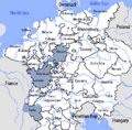
Upper Rhenish Circle-2005-10-15-en.png 727 × 714; 67 KB
-
Upper Saxon Circle-2005-10-14-de.png 727 × 714; 66 KB
-
Upper Saxon Circle-en.png 727 × 714; 163 KB
-
Upper Saxon Circle-hu.PNG 610 × 599; 207 KB

